This spring my hiking compadre Karl extended an invitation to join him on his annual early season hike on the PCT. I am used to snow in the High Sierra, and I usually bring snowshoes and serious winter gear. . . but Karl assured me that in the early spring we could go without the usual winter setup and hike on the snow with trail runners. I watched the forecast and snow level indicators online, and it looked like we lucked out and would be enjoying a rare week-long window of sunny skies and plenty of hard packed snow!
That's what I
was thinking at the end of the first day of this loop hike out of Onion Valley
last weekend. Although there were some challenging moments it was a fun trip.
Thanks to Maverick at High Sierra Topix for the route suggestion, I would not have been aware of
this alternate route into Rae Lakes without his recommendation.
I started out
leaving home at 3:30 am on Friday after working till midnight. This seems to be
my routine when trying to leave town for a long weekend, but I was feeling good
and the excitement of a new adventure in the High Sierra kept me going. The
ranger sent me on the way at 8:30 am and with a walk-in permit in hand I
headed up to the Onion Valley TH.
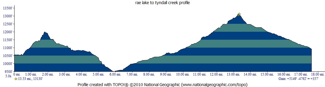
Today was a big day, I wanted to make it over Glen Pass and Forester Pass so I hit the trail by 6:30. The water in Rae Lake was perfectly flat and the view of the Painted Lady was crystal clear. I crossed the outlet of the lake and headed up the switchbacks toward Glen Pass.
Morning on Rae Lakes.
Soon I was at the first plateau on the way up the pass. There were a few beautiful alpine lakes on the right and I could see the trail along the north side of the pass, carved into the mountain. The views on the way up were amazing.
View from Glen Pass.
Video on the way up Glen Pass.
After taking a quick break at the top I headed down toward the tarn on the south side.
Switchbacks on the south side of Glen Pass.
Eventually I descended to Charlotte Lake and started to see groups of people camping along the trail. There are several trail junctions in this mostly flat dusty area and I had read that it was easy to get disoriented here. I was surprised to see one group that was camped right next to the trail with music blasting and some laundry drying on top of a trail sign, covering the sign. After days in the pristine wilderness it was disheartening to see such a lack of common courtesy. Was I becoming a trail snob? Probably, but it really didn't matter, . . . soon I was back in nature.
I made it through the many trail junctions and down the switchbacks to lower Vidette Meadow. I was making good time and before long I was back out of the trees and at the base of Forester Pass. I was chasing the afternoon storm clouds up the pass, but fortunately there was no rain.
Looking back towards Vidette Meadow on the way to Forester Pass.
The trail on the way to Forester Pass.
Almost at the top of Forester Pass. Junction Peak in the background.
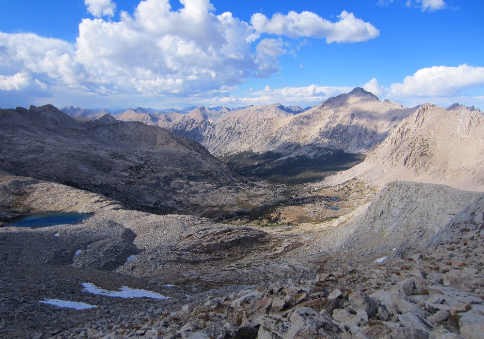
The view north from Forester Pass, looking back from where I started.
The view south from Forester Pass, looking south toward Mt. Whitney.
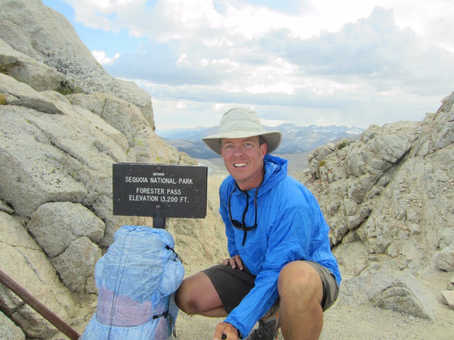
Forester Pass (13,200 feet).
The trail on the south side of Forester Pass.
Video looking down the cliff on the south side of Forester Pass.
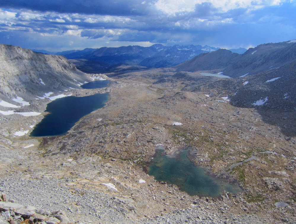
The trail through the huge flat area below the pass was another amazing plateau, a welcome change after climbing Forester.
Looking back at Forester Pass.
There are beautiful lakes just below Diamond Mesa where I had planned on camping, but I just kept going while feeling great at the end of the day.
I hiked well into the evening while looking for a spot to camp, but I just didn't want to stop. I knew if I stopped I would actually feel the soreness in my legs. I was ok if I just kept moving. Eventually I made it to a designated camp area (with bear boxes) by Tyndall Creek (just before the Shepherd Pass junction). I was hiking by headlamp and a nice couple helped me find a place to camp.
I setup camp and made dinner in the dark. It was a great day, having hiked over Glen Pass and Forester Pass. I slept like a baby.
In the morning the storm from yesterday was long gone and the view back toward Upper Basin and Mather Pass was crystal clear.
Upper Basin and Mather Pass from camp.
It was a clear morning and soon I was at the top of Pinchot Pass. The views to the north of Marjorie Lake were amazing. Like the views from many of the passes on the JMT, the vast scale of the area is hard to express or capture in photos.
Looking north from Pinchot Pass.
To the south of Pinchot Pass is a beautiful alpine area with meandering streams and wide open views of the red colored mountain peaks to the west. The view from below the pass of the gigantic southwest face of Mt. Wynne highlights the stripes of light colored granite. The trail is easy and I made good time to the Sawmill Pass trail junction.
The view of Mt. Wynne and Pinchot Pass (on the left) from the south side of Pinchot Pass.
The trail on the south side of Pinchot Pass.
The section of trail from Sawmill Pass to Woods Creek suspension bridge was probably my least favorite part of the JMT. It follows mainly granite stairs up and down along the creek for almost 4 miles. It may be that not eating enough was starting to tap my energy with some lagging at this point in the day. Sometimes I just didn't want to stop and eat, but by the time I reached the bridge I forced myself to stop for lunch. Feeling a little better I crossed the Woods Creek bridge. The suspension bridge was a big landmark for me. After reading so many trip reports about the bridge I was excited to see it in person.
Woods Creek Bridge.
I took a video while crossing the bridge. There are many camp sites on the opposite side, but as usual the entire area was vacant this late in the season. I saw one couple that looked like they were having a disagreement which made me extra stoked to be solo on the JMT. Just me and nature. Sweet!
Crossing the Woods Creek bridge.
The trail up to Rae Lakes from Woods Creek is steeper than I had anticipated and I just kept my slow and steady pace up the switchbacks and rocky trail. It started to rain lightly as I passed through some of the forested area. I passed a good large camp site littered with downed trees about half way up to the lakes. Later a small group would ask if there was a good camp for them nearby and I recommended the area.
Soon I reached the Dollar Lake and missed the classic photo opportunity of the lake with Fin Dome in the background. More time for photos later.
For the first time on the entire JMT I started to see large groups of people camping along the trail. At Arrowhead Lake there were a few groups of people wearing full rain gear taking photos along the lake. Full size free standing double wall tents, guys standing around in boots and warm jackets talking about the 'real world'. It all seemed so strange. I was warm as long as I kept moving along in shorts, t-shirt and trail runners. The light rain was keeping me at a nice comfortable temperature and I was hitting my late afternoon second wind. It felt like all of the less picturesque parts of the trail earlier in the day were a small price to pay to enjoy these late afternoons.
First view of Glen Pass under cloudy skies.
I could hear a group of people hanging out at the ranger station as I passed by but I just kept moving. After being on the trail solo for so long I wasn't anxious to break the mesmerizing feeling of being 'with' nature. The view of the first Rae Lake was beautiful and the storm clouds still hadn't produced much rain. I picked up the pace and started looking for good camp sites. I remember seeing a trip report where someone had camped right above the southern Rae Lake with good views of the Painted Lady. I just kept going and figured at worst I would find something just below Glen Pass.
Finally I reached the last Rae Lake and the views matched the pictures I had seen before. I hiked up a bluff up to a plateau and found several flat camp sites with great views of the lake and Painted Lady. After setting up camp I was a little startled by a man who came out of nowhere to say hi. He was camping nearby at the lakes outlet and was in the middle of a week long stay. After chatting for a while I made dinner (in the dark) and got to be early. The plan was to get up early and make it over Glenn Pass and Forester Pass to set up for the final stretch toward Whitney.
Camp on bluff overlooking Rae Lake and the Painted Lady.