The popular "North Lake to South Lake Loop" or "Evolution Loop" is usually referred to as a "loop". . . The Forest Service and Recreation.gov describe it as the "North Lake to South Lake Loop". There are countless online trip reports for the "loop" including some on Summitpost, Backpackinglight and High Sierra Topix. I stopped counting after finding 14 videos for the "loop" on YouTube.
According to the FKT site the current fastest known time for the "Evolution Loop" is 10 hours and 31 minutes. Impressive, although not so much considering the FKT holder had to hitch a ride back to North Lake after "finishing" at South Lake.
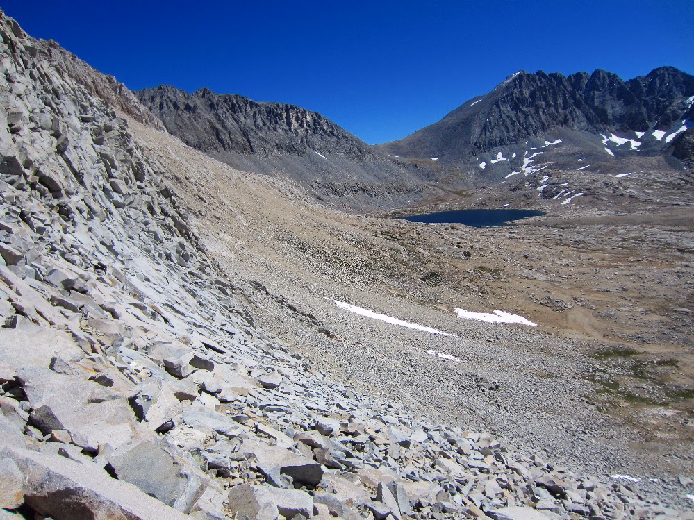
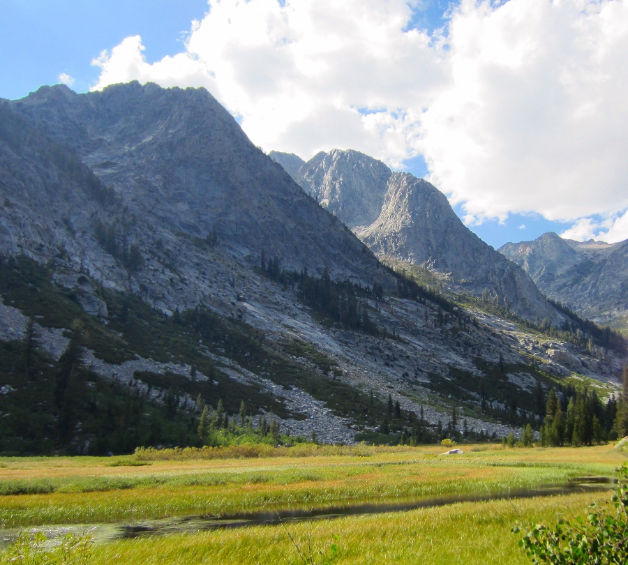
I have often wondered what it would be like to do a proper loop and include the last section over the Tyee Plateau and close the circle back to North Lake . . . So last week I hiked from North Lake to North Lake and along the way threw in some cross country travel and peak bagging to keep it interesting. In the end it was a 64+ mile loop with four passes and 34,200' of elevation change.
I started with my usual late night drive through the desert on Wednesday night to camp at the base of the East Side of the Sierra near Independence. Spending a night at 4,000' always helps me acclimatize to the big climb over the Sierra Crest on the first day, and by Thursday morning I was ready for the climb over Lamarck Col from the North Lake trailhead.
This spring my hiking compadre Karl extended an invitation to join him on his annual early season hike on the PCT. I am used to snow in the High Sierra, and I usually bring snowshoes and serious winter gear. . . but Karl assured me that in the early spring we could go without the usual winter setup and hike on the snow with trail runners. I watched the forecast and snow level indicators online, and it looked like we lucked out and would be enjoying a rare week-long window of sunny skies and plenty of hard packed snow!
Taboose Pass - Center Basin - Lake Marjorie - Bench Lake
With only a few more days of good weather before the first real winter storms hit I headed up Taboose Pass for a five day cross country solo trek. Taboose Pass is one of the four steep passes that provide relatively quick access over the Sierra Crest and directly into the High Sierra. The price for such convenient access are big climbs of around 6,000 feet in under 10 miles. In the summer a very early start is required to avoid the hot temperatures at lower elevations, but by starting in the fall the weather was enjoyable the entire way.
Once over Taboose Pass the plan was to cross three off-trail passes into some remote basins that have been on my radar for a few years. The fall colors were beautiful but unfortunately there was enough snow lingering on the north facing slopes that I had to avoid my cross country plans and stay in the relative safety of Center Basin, Lake Marjorie and Bench Lake.
I left my comfortable camp and got an early start up the switchbacks of the JMT along upper LeConte Canyon. I would be leaving the Sierra High Route at Echo Col and eventually back to my car at the Sabrina Basin trailhead.
Tarn above Guitar Lake to Whitney Portal: 16.5 Miles
Sept. 22nd, 2011.
I woke up to the sound of groups of hikers passing by at 3:45 am. They were heading up the switchbacks by headlamp. I wasn't comfortable hiking on an unfamiliar trail at high elevation by headlamp, so I relaxed and dozed off.
Within an hour or so I could see their headlamps on the side of the mountain, way way up toward the top. A friend had told about seeing this same thing many years ago, and now here I was.
By 6:30 am I had gathered my gear and while wearing every piece of clothing I had I started up the trail toward Mt. Whitney. For the first 20 minutes it was seriously cold, but soon I removed almost everything and hiked there rest of the way in shorts with silk long johns, a wind breaker and lightweight hat/gloves.
The views of Mt. Hitchcock and Hitchcock Lakes in the sunrise was beautiful. While hiking up toward Trail Crest I passed a few bivy camp sites (possible camp spots for next time). The trail was basically dug out of the granite most of the way. There was a storm passing from the east and although it was sunny there was snow blowing over from the other side of the ridge.
Tyndall Creek to tarn above Guitar Lake: 13.5 Miles
Sept. 21st, 2011.
This was a relaxing day with low mileage and easy terrain. I stopped to clean up a bit at the Tyndall Creek crossing and made my way through some lightly forested areas toward the Big Horn Plateau. The amazing views of the Kaweah mountain range started to open up through the trees. . .
Today was a big day, I wanted to make it over Glen Pass and Forester Pass so I hit the trail by 6:30. The water in Rae Lake was perfectly flat and the view of the Painted Lady was crystal clear. I crossed the outlet of the lake and headed up the switchbacks toward Glen Pass.
Morning on Rae Lakes.
Soon I was at the first plateau on the way up the pass. There were a few beautiful alpine lakes on the right and I could see the trail along the north side of the pass, carved into the mountain. The views on the way up were amazing.
View from Glen Pass.
Video on the way up Glen Pass.
After taking a quick break at the top I headed down toward the tarn on the south side.
Switchbacks on the south side of Glen Pass.
Eventually I descended to Charlotte Lake and started to see groups of people camping along the trail. There are several trail junctions in this mostly flat dusty area and I had read that it was easy to get disoriented here. I was surprised to see one group that was camped right next to the trail with music blasting and some laundry drying on top of a trail sign, covering the sign. After days in the pristine wilderness it was disheartening to see such a lack of common courtesy. Was I becoming a trail snob? Probably, but it really didn't matter, . . . soon I was back in nature.
I made it through the many trail junctions and down the switchbacks to lower Vidette Meadow. I was making good time and before long I was back out of the trees and at the base of Forester Pass. I was chasing the afternoon storm clouds up the pass, but fortunately there was no rain.
Looking back towards Vidette Meadow on the way to Forester Pass.
The trail on the way to Forester Pass.
Almost at the top of Forester Pass. Junction Peak in the background.
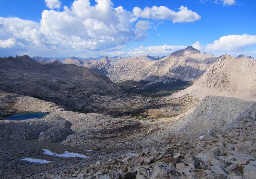
The view north from Forester Pass, looking back from where I started.
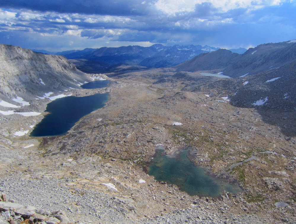
The view south from Forester Pass, looking south toward Mt. Whitney.
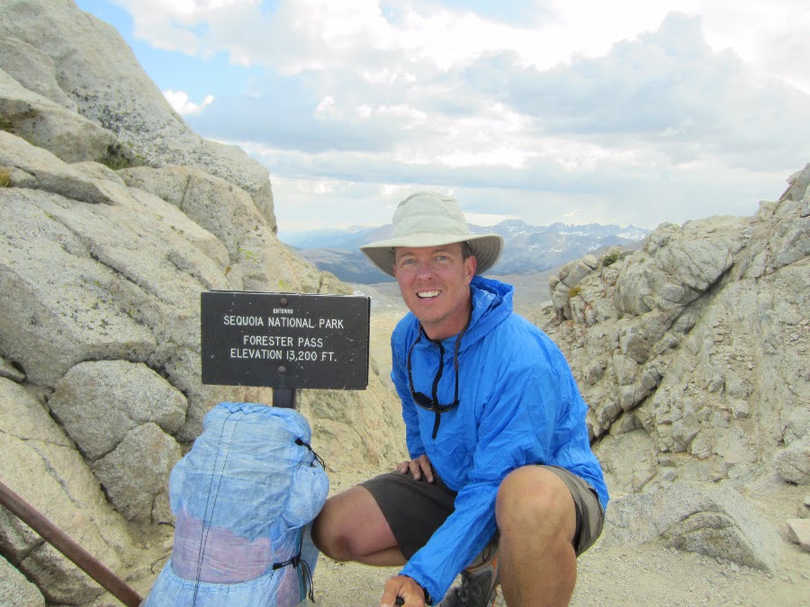
Forester Pass (13,200 feet).
The trail on the south side of Forester Pass.
Video looking down the cliff on the south side of Forester Pass.
The trail through the huge flat area below the pass was another amazing plateau, a welcome change after climbing Forester.
Looking back at Forester Pass.
There are beautiful lakes just below Diamond Mesa where I had planned on camping, but I just kept going while feeling great at the end of the day.
I hiked well into the evening while looking for a spot to camp, but I just didn't want to stop. I knew if I stopped I would actually feel the soreness in my legs. I was ok if I just kept moving. Eventually I made it to a designated camp area (with bear boxes) by Tyndall Creek (just before the Shepherd Pass junction). I was hiking by headlamp and a nice couple helped me find a place to camp.
I setup camp and made dinner in the dark. It was a great day, having hiked over Glen Pass and Forester Pass. I slept like a baby.
In the morning the storm from yesterday was long gone and the view back toward Upper Basin and Mather Pass was crystal clear.
Upper Basin and Mather Pass from camp.
It was a clear morning and soon I was at the top of Pinchot Pass. The views to the north of Marjorie Lake were amazing. Like the views from many of the passes on the JMT, the vast scale of the area is hard to express or capture in photos.
Looking north from Pinchot Pass.
To the south of Pinchot Pass is a beautiful alpine area with meandering streams and wide open views of the red colored mountain peaks to the west. The view from below the pass of the gigantic southwest face of Mt. Wynne highlights the stripes of light colored granite. The trail is easy and I made good time to the Sawmill Pass trail junction.
The view of Mt. Wynne and Pinchot Pass (on the left) from the south side of Pinchot Pass.
The trail on the south side of Pinchot Pass.
The section of trail from Sawmill Pass to Woods Creek suspension bridge was probably my least favorite part of the JMT. It follows mainly granite stairs up and down along the creek for almost 4 miles. It may be that not eating enough was starting to tap my energy with some lagging at this point in the day. Sometimes I just didn't want to stop and eat, but by the time I reached the bridge I forced myself to stop for lunch. Feeling a little better I crossed the Woods Creek bridge. The suspension bridge was a big landmark for me. After reading so many trip reports about the bridge I was excited to see it in person.
Woods Creek Bridge.
I took a video while crossing the bridge. There are many camp sites on the opposite side, but as usual the entire area was vacant this late in the season. I saw one couple that looked like they were having a disagreement which made me extra stoked to be solo on the JMT. Just me and nature. Sweet!
Crossing the Woods Creek bridge.
The trail up to Rae Lakes from Woods Creek is steeper than I had anticipated and I just kept my slow and steady pace up the switchbacks and rocky trail. It started to rain lightly as I passed through some of the forested area. I passed a good large camp site littered with downed trees about half way up to the lakes. Later a small group would ask if there was a good camp for them nearby and I recommended the area.
Soon I reached the Dollar Lake and missed the classic photo opportunity of the lake with Fin Dome in the background. More time for photos later.
For the first time on the entire JMT I started to see large groups of people camping along the trail. At Arrowhead Lake there were a few groups of people wearing full rain gear taking photos along the lake. Full size free standing double wall tents, guys standing around in boots and warm jackets talking about the 'real world'. It all seemed so strange. I was warm as long as I kept moving along in shorts, t-shirt and trail runners. The light rain was keeping me at a nice comfortable temperature and I was hitting my late afternoon second wind. It felt like all of the less picturesque parts of the trail earlier in the day were a small price to pay to enjoy these late afternoons.
First view of Glen Pass under cloudy skies.
I could hear a group of people hanging out at the ranger station as I passed by but I just kept moving. After being on the trail solo for so long I wasn't anxious to break the mesmerizing feeling of being 'with' nature. The view of the first Rae Lake was beautiful and the storm clouds still hadn't produced much rain. I picked up the pace and started looking for good camp sites. I remember seeing a trip report where someone had camped right above the southern Rae Lake with good views of the Painted Lady. I just kept going and figured at worst I would find something just below Glen Pass.
Finally I reached the last Rae Lake and the views matched the pictures I had seen before. I hiked up a bluff up to a plateau and found several flat camp sites with great views of the lake and Painted Lady. After setting up camp I was a little startled by a man who came out of nowhere to say hi. He was camping nearby at the lakes outlet and was in the middle of a week long stay. After chatting for a while I made dinner (in the dark) and got to be early. The plan was to get up early and make it over Glenn Pass and Forester Pass to set up for the final stretch toward Whitney.
Camp on bluff overlooking Rae Lake and the Painted Lady.
I woke watching the colors of the sunrise slowly change from purple to bright red to orange. As I packed up the sun made its way down from the top of the surrounding peaks and lit up the Devils Crags across the canyon. The valley filled with light as I hiked up the Golden Staircase. What an unbelievable way to wake up!
Sunrise from camp overlooking Palisade Creek and Devils Crags.
Golden Staircase.
By the time I made it to Palisade Lake the sun was out and it was another beautiful morning. The lake is an amazing sub alpine body of crystal clear water. I could see to the bottom and there was still a large mass of ice deep inside the lake at the entry.
Palisade Lake
Palisade Lake
Palisade Lake
I was looking forward to Mather Pass and the hike up the granite canyon was a beautiful. The trail is almost invisible from below, but there is a well terraced set of switchbacks up to the pass. The view along the way is amazing. The size and scale of the place are HUGE. I could see coming back here and spending a week just exploring the lakes and peaks across the canyon.
I made it to the pass in good time, although by then I wasn't really paying too much attention to the actual time. Time was like something from the 'real world' that I didn't want to be reminded of. What an amazing escape from everything concrete. I felt alive.
View of Palisade Lake on the way to Mather Pass.
Palisade Peaks from the top of Mather Pass (12,100 feet).
I met a couple of guys on Mather Pass who were hiking a portion of the JMT and had met up earlier that week. One of them hiked in from Taboose Pass and the other from South Lake. There were kicking back and hiking at a leisurely pace back to exit via Taboose Pass. When I made some celebratory coffee using my Caldera Cone they came over and asked about ultralight gear etc. I think they were just into using a beer can as part of a stove. . . and it looked like beer was a large portion of their pack weight.
They commented on how strange it seemed to them that people get up at 6:00 am and hike all day. They preferred to fish and enjoy the wilderness in a different way. When I told them I was one of those guys who hikes most of the day so I could see as much as possible this time, they were cool. I think we all realized that everybody chooses to enjoy the wilderness in a different way, and that it's all equalized by the feeling and surroundings. How could anyone be disagreeable out here at the top of Mather Pass. I liked these guys.
I headed down the well graded but steep switchbacks down into Upper Basin. I love the feeling of being in the low flat alpine areas after doing so much ascent earlier in the morning. I slowly made my way back down into the forest and soon I was at the Taboose Pass/JMT junction.
View facing south from Mather Pass.
View facing south from Mather Pass. Upper Basin and Split Mountain.
View facing south from Mather Pass. Steep switchbacks on the way down.
Video from Mather Pass.
Moonscape along Upper Basin.
The afternoon clouds started to look ominous as I headed up the switchbacks toward the Bench Lake junction. By the time I met up with my buddies from Mather Pass it was starting to rain lightly. They decided to pick up the pace and get to Bench Lake for the night. I just kept on my steady pace toward Pinchot Pass. The plan was to camp just below Pinchot Pass, near Marjorie Lake, to get ready for the next morning. The rain was intermittent so I didn't bother getting out my jacket.
By the time I got within a half mile from Marjorie Lake the winds picked up and the storm really got going. Rain, hail and heavy winds suddenly hit hard. When I heard thunder I knew it was time to take some cover, but the terrain was limited to medium sized boulders and clumps of small trees/large shrubs.
I was in shorts, a t-shirt and running shoes and totally unprepared. There was no time to put on my rain jacket or pants when the lightning show began, and I was almost above timberline so I crouched under some shrubs and took cover. There was almost no time between the lightening and thunder. The sound of the thunder echoing against the huge granite walls was deafening and the hail was ridiculous.
I was pretty sure that I should do something to get to a better place, but I wasn't sure what that might be. Go out into the storm and run down an exposed ridge line to lower elevation? Stay put and risk getting hit by lightning? I put on my rain jacket and hunkered down.
After 30 minutes the storm passed and the flowers all exploded. The new snow and hail that had collected on the mountains was beautiful. The post rain fragrance was amazing. I made some dinner by this lake and slept like a baby under clear skies.
My goal for the gear I used on the John Muir Trail in 2011 was to go as lightweight as possible while still being safe and comfortable in a wide range of conditions. With this combination of gear I was ready for the warm days with extreme sun exposure on the mountain passes to very cold nights and severe wind on top of Mt.Whitney.
A bear canister is required on the JMT so the list below is about 1 1/2 pounds heavier than I would usually carry in other areas.
The base weight (all items carried not counting food, fuel and water) is just over 8 lbs. This includes a camera and Spot II personal locator beacon in case of emergency and to track my progress.
There are several items on the list that I made myself. I designed the cuben backpack borrowing generously from some of my favorite ultralight packs. The down quilt was made using a kit from http://www.thru-hiker.com/ , although I used Momentum55 instead of the fabric that came with the kit. Momentum55 is a new extemely lightweight downproof/windproof fabric that has a triple DWR to shed water spray. The quilt has 12 ozs of down and is rated to 20 degrees. For the windshirt and rain jacket I used a pattern from http://www.thru-hiker.com/. I can't beleive that I hiked and camped for so many years without a windshirt. It is a very usefull item, especially considering the light weight. My rain gear is very similar to my wind shirt, except that I used 0.51 oz/sqyd cuben fiber from http://www.zpacks.com/. I added large pit zips to the rain gear to provide some breathability.
After almost a year of researching and trying a lot of different gear this is my latest version, of course subject to change. . .
Le Conte Canyon to the base of the Golden Staircase: 12.5 miles.
Sept. 17th, 2011.
Today was a partial rest day. I made coffee, did some laundry and just enjoyed the scenery before hitting the trail. I lucked out last night and found an amazing (and once again vacant) large flat camp site right next to the Kings River. There were three large flat areas and plenty of room for three mid sized groups, but it was just me. I did laundry using a 1 gallon zip lock bag and some camp suds, rinsing everything well away from the river. There was a series of large waterfalls visible just upstream that made for an amazing scene, and frogs. Lots of frogs. While making breakfast and chilling by the river a few very friendly frogs came over and just hung out. They must be used to seeing plenty of people at this prime camp spot, but again I hadn't seen anyone since yesterday late afternoon. I've heard the JMT referred to as a highway, but this late in the season it felt like I had it mostly to myself. I typically would run into two or three other people or groups along the trail each day.
Kings River by campsite on day six.
By around 1:00 pm I headed down toward Big Pete Meadow. I passed the famous rock sculpture and later the sign by the Le Conte Ranger Station warning of bears. Some amazing mountain peaks and waterfalls from a hanging valley far far above came into view on the right. The Citadel (11,738 feet) was over 3,000 feet above me and the waterfalls coming down the canyon walls were mesmerizing. I took a few pictures from Grouse Meadows but the sun wasn't cooperating.
Grouse Meadow
The trail from Big Pete Meadow to the Palisade Creek junction was mostly flat and I made good time along Palisade Creek. There were many comfortable camp sites under the forested Deer Meadows area and I passed a few groups already having dinner, but I was hitting my familiar late afternoon stride and I wanted to keep going. . . as usual I was chasing the late afternoon sun. If I was more of a morning person I would have been making an extra five or ten miles a day, but it was time to find a spot to camp. I could see a large waterfall at the end of the canyon and it looked like there might be a plateau at the top.
I raced the sun up the stone switchbacks that lead to the top of the falls. I was bolting up the granite stairs, sometimes bushwhacking through lush ferns that were fed by the many waterfalls and seeps coming down the canyon walls. I figured that at the worst I would just stealth camp anywhere that was reasonably flat, and just as I was loosing hope of finding a descent place to camp. . . I made it to the plateau by the waterfall.
I could hardly believe my luck when I found two small flat spots just big enough for a small tent or bivy right by the top of the waterfall. The view looking back over the canyon was amazing. On either side were huge granite walls rising almost 4,000 feet from the floor of the canyon to Giraud Peak (12,608 ft.) on the right and Mt. Shakespeare (12,174 ft.) on the left. At the opposite end of the canyon were the mountains and peaks of the Black Divide. The Devils Crags, Wheel Mountain (12,774 ft.), Mt. McDuffie (13,282 ft.) and The Citadel (11,739 ft.). I was at the far west end of the canyon and knew I was set for an amazing sunrise.
Camp just below the Golden Staircase.
Alpenglow.
As I set up my quilt and bivy the sun was making it's way up the canyon walls behind me. I watched the alpenglow too long and ended up making dinner by the waterfall in the dark. Any thought of the 'real world' was long long gone. I was completely taken by the peace of this amazing place. I drifted off to sleep listening to the waterfall and watching the stars come out, framed by the awesome walls of granite on either side.
Camp overlooking Palisade Creek, Deer Meadow and Devils Crags.