Virginia Lake to Quail Meadows: 13.4 miles.
Sept. 13th, 2011.
I slept in late after tossing and turning most of the night. The bear scare didn't do much for a restful night and my first night at altitude is usually restless anyway. Fortunately the ominous clouds didn't bring much rain during the night. It was around 9:00 am before I finally made it out of the warmth of my quilt to check on the condition of my bear canister and stove. When I went over to check I couldn't believe what I saw. They were both exactly where I had left them the night before. Was my mind playing tricks on me? Was I losing it? Maybe it was the altitude. . .
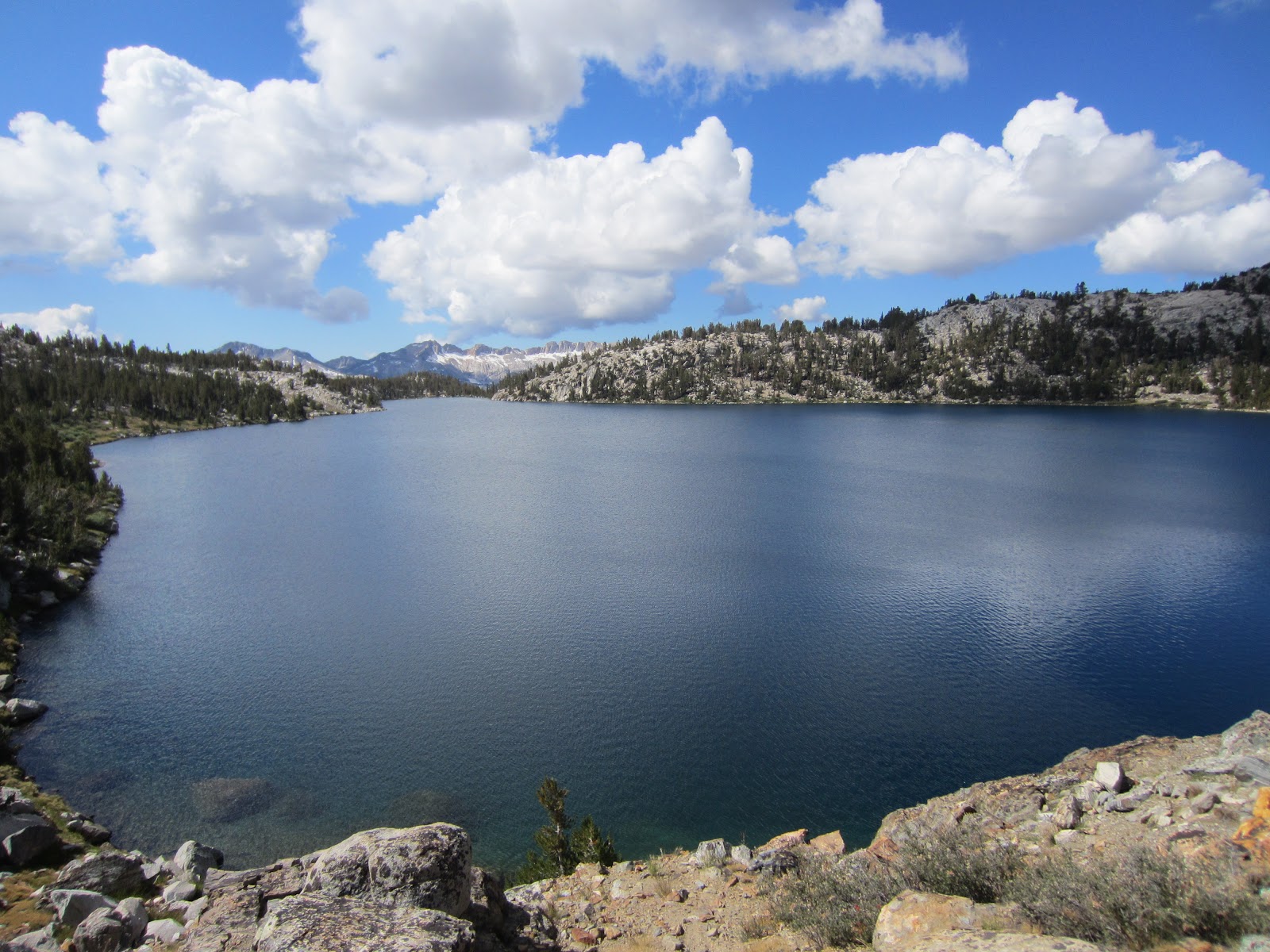
I made breakfast and stretched/rolled sore muscles while taking in the view of Virginia Lake. The storm had passed and I inhaled a breakfast of dehydrated eggs & ham.
I was still working out the best way to sleep comfortably with my pad and quilt. I woke up with a cold spot right in the middle of my quilt and my legs were getting cold from the ground. It would be awhile till I dialed everything in. Eventually I learned how to move the down around from inside the quilt to where it was needed to stay warm. Within the next few days I found the perfect combination of a Gossamer Gear Thinlight pad, Kookabay Taperlite inflatable pad, Kookabay inflatable pillow, my backpack and various clothing items and rain gear to sleep warm and comfortable.
On the way to the trail I stopped by the lake to fill up on some water. It was then that I realized I had left the small 'mix bottle' for my AquaMira back at the bridge over Duck Creek. I washed out a small bottle that I was using for Camp Suds to use for mixed AquaMira, but my water tasted like soap for a while. It felt like I was moving in slow motion, and I didn't get back on the trail until 10:50 am.
 |
| Virginia Lake with the Silver Divide in the background. |
 |
| Virginia Lake from the trail. |
The trip down the switchbacks to Tully Hole was pleasant, the trail was well graded and the view of the Silver Divide was amazing. Pictures don't do this area justice. I stopped and made coffee about half way down. After about 800 feet of downhill I was in Tully Hole and the south end of the Cascade Valley. The trail follows Fish Creek for a few miles and the terrain is beautiful. A mix of light forest and the flowing creek made for a pleasant walk. I passed a group of older retired guys hanging out by the creek. I thought it would be cool to be spending retirement out here.
Soon I was heading back up switchbacks toward Silver Pass. I passed Warrior Lake and Chief Lake while following a series of carefully constructed granite stairs. This sub-alpine area would be a great place to camp, especially in better weather, but the clouds were gathering again and it was time to keep moving.
 |
| The view of the Silver Divide from the top of the switchbacks to Tully Hole. |
I noticed that while going up these early passes that I couldn't get a full breath of air. It was like trying to get a full breath in a city with really bad air quality (like L.A. in the 70's) except the air was crystal clear. I could still move along fine, but it would be another day before I got my trail legs/lungs.
 |
| Granite stairs on the way up to Silver Pass. |
 |
| Warrior Lake on the way up Silver Pass. |
 |
| Chief Lake on the way up to Silver Pass. |
The view from the top of Silver Pass included a panorama of the Cascade Valley, the lakes below and Mt. Banner & Ritter in the distance. This would have been the last view of these dark volcanic peaks, but they were hidden in the clouds.
I hadn't paid much attention to the amount of downhill when studying the maps, but I was in for a big day. From Silver Pass (10,895) to Quail Meadows (7,870) I would be dropping over 3,000 feet. Some of the granite stairs on the way down to Pocket Meadow were brutal. There were plenty of nice camp sites along the North Fork Mono Creek, but I still had plenty of time and energy to keep going.
 |
| The view from the top of Silver Pass. Cascade Valley is in the distance. Mt. Banner & Ritter are in the clouds. |
It was along this section that I came across a man sitting alongside the trail with his head down. He had been heading up from Edison Lake with a heavy resupply and looked like he was in bad shape. I tried not to startle him when I asked if he was OK. He looked up and was covered in sweat, drowning in several layers of clothes, a huge gortex parka and a large fully loaded external frame backpack. I asked if he had water and if I could help, but he assured me would be ok. . . so I continued down the switchbacks to Quail Meadows. I still can't figure out why he would carry so much stuff just to 'get away from it all' in nature.
After crossing the bridge over Mono Creek I found several large campsites on the south side of the creek and picked out one of many large flat areas. It looked like this was probably a very popular spot during the middle of summer, but it was mid September and the place was a ghost town.
It started to rain just as I put up my tarp. When it stopped long enough I had dinner by the river and made it back to my tarp just in time for more rain throughout the night. The sound of rain was soothing after a day of so much downhill. I slept like a baby.
 |
| Camp at Quail Meadows. Ready for another rainy evening. |
 |
| A map of day 2 progress (click for full size). |
 |
| Virginia Lake to Quail Meadows elevation profile (click for full size). |
Click here for John Muir Trail Thru Hike: Day Three


