After taking a few winter trips in the local San Jacinto mountains this winter I was excited to take a real Sierra winter trip. For my first real winter experience in the Sierras I decided to start from familiar ground, the North Lake trailhead near Bishop. The plan was to cross the Sierra Crest at Piute Pass, then cross the Glacier Divide at Alpine Col and finally back over the Sierra Crest at Lamarck Col. I had four days and three nights to make the loop on snowshoes.
Driving out of Bishop for some big mountain adventure.
The roads were closed just outside of Aspendell so I parked and walked the three miles to the actual North Lake/Piute Pass trailhead.
Piute Pass trailhead.
By the time I got started it was already 1:30 pm so I camped on a ridge just below Piute Lake (only a few miles from the trailhead).
Camp on a ledge just below Piute Lake.
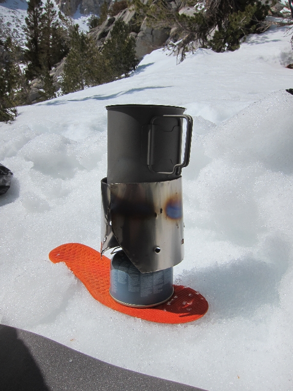
All of the lakes and streams are frozen at this altitude so I had to melt snow for water during the rest of the trip. I used some Toasty Feet inserts to insulate the fuel from the snow.
Homemade titanium windscreen.
The next day I got another late start and after a long breakfast, coffee and chill time I headed up to Piute Pass.
Piute Lake was frozen and there were tracks directly across the middle.
There is a small cabin on the opposite side of the lake I had heard about from the ranger. He had used it as a shelter during a recent snowhoe trip.
Small cabin on the opposite side of Piute Lake.
Soon the pass was in sight, but there was a large cornice right at the top.
Piute Pass in the distance.
Fortunately the cornice was stable and I walked right by with no problem.
Snow wave at the top of Piute Pass.
This was a solo trip. When I got my permit the ranger said, "you probably won't see anybody out there this time of year". I wouldn't see another person for five days. It's always strange talking to people after a long solo trip. For now I was just enjoying the complete absence of anything except big mountain scenery and solitude.
Self portrait.
The view of Mount Humphreys dominates the area.
Mt. Humphreys.
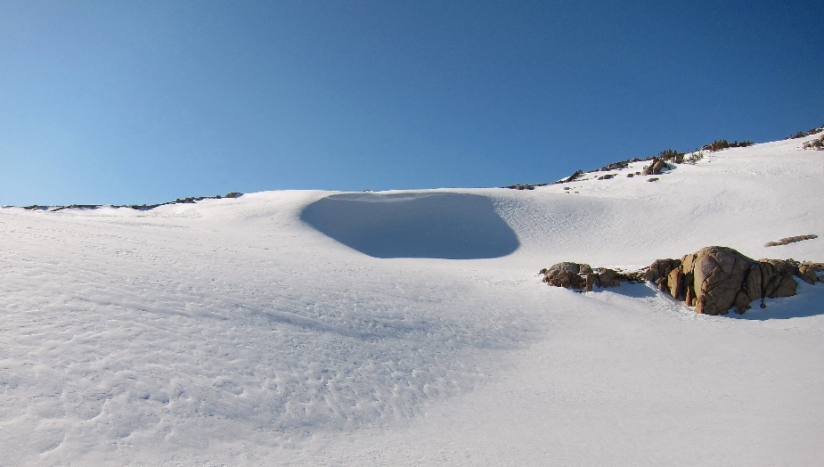
Since the lakes are frozen I just walked over frozen Muriel Lake.
Snowshoe route from Piute Pass over frozen Muriel Lake.
I camped right above frozen Goethe Lake with an amazing view of Humphreys Basin.
Mountain Laurel Designs cuben Solomid.
The next morning I got an early start for Alpine Col.
Camping on a ridge overlooking frozen Goethe Lake.
The hike up to Alpine Col was beautiful with rolling waves of pristine snow.
The route up to Alpine Col.
Closer to the top it got very steep and the altitude started to make the climb a challenge.
Climbing to Alpine Col.
The view west from the top of Alpine Col (12,500 feet).
The view to the east from Alpine Col. Mt. Mendel and Lake 11,910.
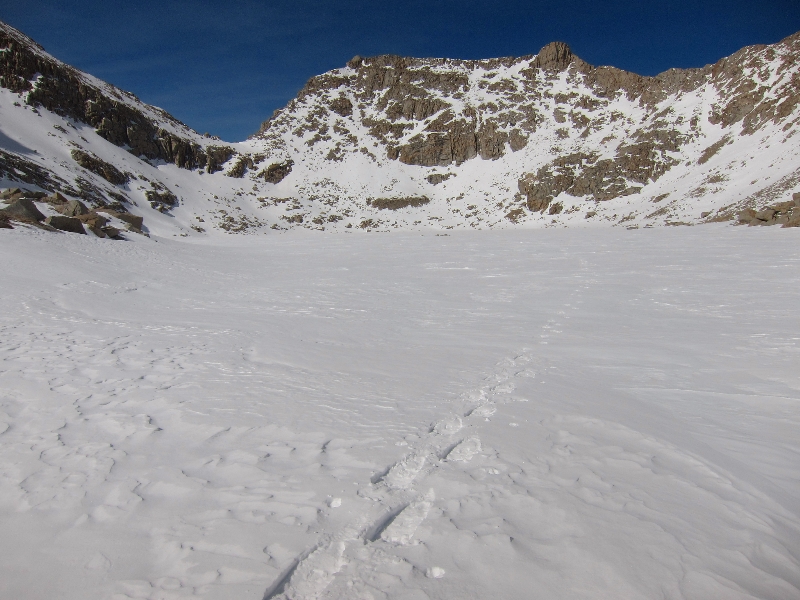
I glissaded down the east side of Alpine Col and walked across Lake 11,910. This area is so remote that most lakes are just named after the altitude.
Snowshoeing across Lake 11,910. Alpine Col is the low spot on the left.
This is the first living thing I had seen in days.
That night I camped in Darwin Canyon, surrounded by frozen lakes and huge peaks (Mt. Darwin and Mt. Mendell, both over 13,000 feet).
Camping in Darwin Basin.
Once I got to the last lake I started the climb up to Lamarck Col (12,880 feet).
There was a sandy beach here last October.
Here is the same lake last October.
I crossed back over the Sierra Crest at Lamarck Col (12,880 feet).
Lamarck Col (12,880 feet).
The view back to the east of Darwin Canyon.
The view to the east from Lamarck Col.
I glissaded down from Lamarck Col.
Glissading down from Lamarck Col.
This trip was supposed to be four days/three nights but I ran into a lot of difficulty finding the way down from a steep snow covered ridge to Upper Lamarck Lake. I spent hours trying to find a safe way down. At one point I fell into an opening in the snow and into the hidden boulders below. My snowshoes got caught under the boulders as the snow filled in the opening. I spent a long time on this steep ridge digging myself out but eventually I got down to Lower Lamarck Lake. By that time it was 8:00 pm and completely dark. The trails were covered with snow and the small amount of moonlight wasn't enough to find the way. I decided it would be safest to just sleep there until the morning.
Camping under a tree next to Lower Lamarck Lake I fell asleep listening to the winds howl through the canyon. I watched the stars flickering through the branches above me as the melting creek flowed nearby. It was one of the most amazing nights I have spent in the wilderness.
The last night I just slept under this tree by Lower Lamark Lake. It was a peacefull night.
The next day I made my way back down to the North Lake trailhead and finally back to the car. There was a note on my truck from the local sheriff saying, "The owner of this truck is an overdue/missing hiker. Please call. . . ". My family was aware of my location from the Spot messages I had been sending, but they still worried something was wrong. Fortunately everything was just fine. What an adventure!
Enjoyed reading about your trip; such an adventure with the snowshoes getting wedged under the boulders. I carry a scoop I got at REI yrs ago to dig myself out. Very challenging to get out when shoes are wedged under snow. Loved the dialogue and of course your pictures. You are a skilled mountain main. Thanks
Thanks Sharry, and I appreciate the tip about the scoop from REI (great idea)! I have since gone back and used the winter route via the Grass Lake drainage and it is much easier/safer.


wow!
ReplyDeleteRight on obxcola!
DeleteThank you for the pictures. Nice trip!
ReplyDeleteThanks, glad you liked the pxts. See you on the trail.
DeleteAwesome. Thanks for allowing me see familiar territory under it's winter blanket.
ReplyDeleteThanks Karen. I have been enjoying reading your posts and photos online (Facebook and HST I think). Sierra Spirit! Andy.
DeleteEnjoyed reading about your trip; such an adventure with the snowshoes getting wedged under the boulders. I carry a scoop I got at REI yrs ago to dig myself out. Very challenging to get out when shoes are wedged under snow. Loved the dialogue and of course your pictures. You are a skilled mountain main. Thanks
ReplyDeleteThanks Sharry, and I appreciate the tip about the scoop from REI (great idea)! I have since gone back and used the winter route via the Grass Lake drainage and it is much easier/safer.
Delete