North Lake to North Lake Loop ~ 2017

Sunrise below Muir Pass. 

The popular "North Lake to South Lake Loop" or "Evolution Loop" is usually referred to as a "loop". . . The Forest Service and Recreation.gov describe it as the "North Lake to South Lake Loop". There are countless online trip reports for the "loop" including some on Summitpost, Backpackinglight and High Sierra Topix. I stopped counting after finding 14 videos for the "loop" on YouTube.

According to the FKT site the current fastest known time for the "Evolution Loop" is 10 hours and 31 minutes. Impressive, although not so much considering the FKT holder had to hitch a ride back to North Lake after "finishing" at South Lake.

I have often wondered what it would be like to do a proper loop and include the last section over the Tyee Plateau and close the circle back to North Lake  . . . So last week I hiked from North Lake to North Lake and along the way threw in some cross country travel and peak bagging to keep it interesting. In the end it was a 64+ mile loop with four passes and 34,200' of elevation change.

I started with my usual late night drive through the desert on Wednesday night to camp at the base of the East Side of the Sierra near Independence. Spending a night at 4,000' always helps me acclimatize to the big climb over the Sierra Crest on the first day, and by Thursday morning I was ready for the climb over Lamarck Col from the North Lake trailhead.


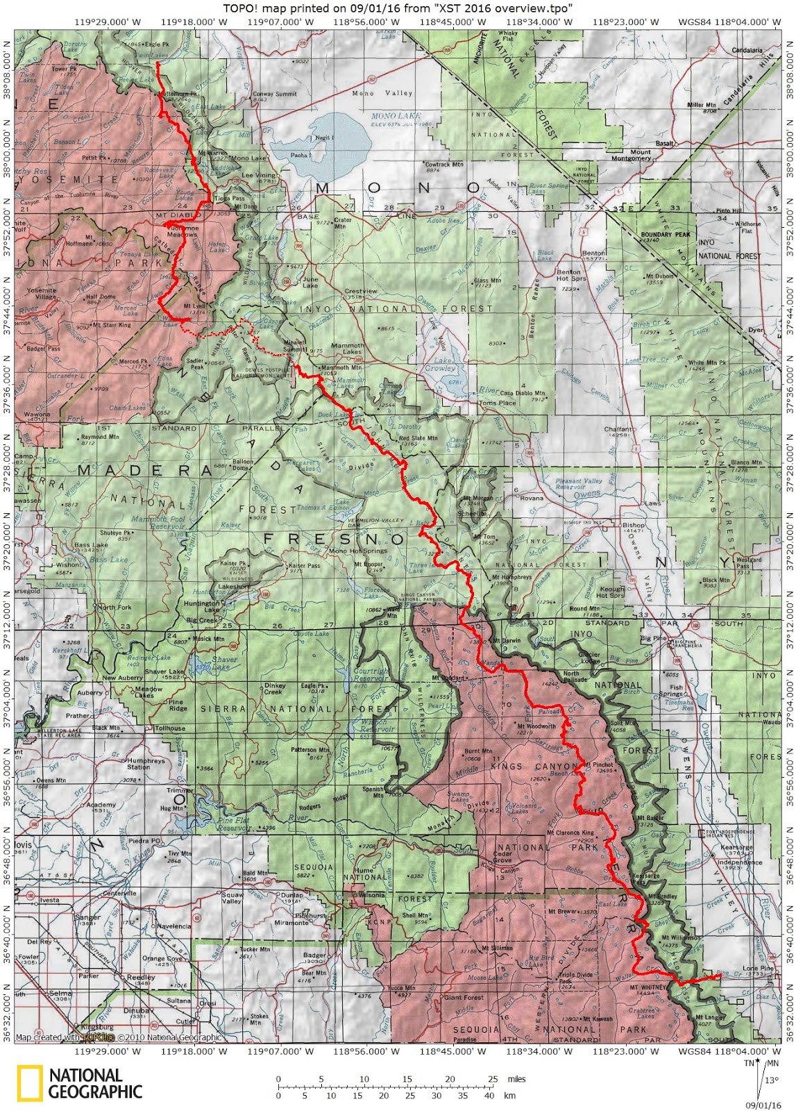
North Lake to North Lake Loop, 64 miles. 

Mt. Whitney to Mt. Langley Traverse~ September 2016

The summit of Mt. Whitney 14,500'.
In the spirit of Alastair Humphrey's Microadventure I took off for a quick late season adventure into the High Sierra last weekend. In an effort to fit as much adventure into a 'micro' amount of time I decided to climb the two nearest 14'ers in the Southern Sierra and hike the distance between each one via a 30 mile cross country route along the way.

To make this a mini-thru hike I left a car at Horseshoe Meadows at the southern end of the route and took a shuttle to Whitney Portal in the north where I would begin. Although the route was only 30 miles the total elevation change was over 23,000 feet via mostly cross country terrain with a few class III climbs to keep things interesting.

Once the shuttle dropped me off at Whitney Portal the only way back to the car was to commit to the route. . . and I began to wonder if my plan was too adventurous for just one weekend.

Mt. Whitney & Mt. Langley Microadventure route.

XST 2016 ~ Cross Country Sierra Traverse

Mt. Ansel Adams along the XST - Cross Country Sierra Traverse

This year the mountain gods provided a tremendous opportunity. . . a three week window during the prime summer season to explore the High Sierra. Through a series of unplanned circumstances my usual one week trip morphed into a three week epic adventure! After pouring over maps and considering many possible routes I finally settled on a cross country traverse of the High Sierra. . . I stitched together portions of the Sierra High RouteSouth Sierra High RouteKings Canyon High Basin Route along with some of my favorite cross country alternatives to create a cross country traverse of the High Sierra. 

In the end I climbed 25 High Sierra Passes over 257 miles in 22 days. I started preparing for the trip in January and followed Alan Dixon's training program which included long weekend hikes up to 30 miles per day leading up to the start in July. Some of the climbs and long days were more challenging than I anticipated and the fields of wild flowers at the beginning almost derailed the whole trip. Although I planned on climbing 31 passes over 295 miles I had to skip the sections from the Lyell Fork to Mammoth and Ionian Basin due to allergies. Fortunately I was able to re-energize during a zero day and get back into the wilderness to finish the route. 

Many thanks to the endless support from my wife Candy. I missed you! 


~ XST 2016 ~ 


Cross Country Sierra Traverse: 25 Passes over 257 miles.


XST 2016 ~ Cross Country Sierra Traverse