Anza Borrego 2012

Many thanks to Nick Gatel from Backpackinglight.com for organizing a fun trip through some of his stomping grounds in the Anza Borrego desert. We left our GPS units at home and followed Nick along mostly cross country routes that were based on his experience in the area. After leaving the Alcoholic Pass TH on Saturday we didn't see another person (or human footprint) until hiking out on Sunday. 


We followed a wash/trail up to Alcoholic Pass. Nick mentioned that the pass is named after the cattle ranchers who used this pass to access the bars in Borrego Springs many years ago. 


After a quick 600 foot incline we made it over Alcoholic Pass with some good views of the Santa Rosa Mountains.


Walking through Chola gardens on the way toward Butler Canyon. . . 


Soon we were following Butler Canyon. 


Then up the remains of an old indian 'trail' cross country toward the Playa.


The Playa with the Santa Rosa & San Jacinto Mountains in the distance.


Nick decided to sleep under the stars and was trying out a Zpacks poncho/groundsheet, Neo-Air and cuben quilt. 


Jace kicked it in luxury, a GG Squal Classic. When he needed some advice with the tent Glen Van Peski actually invited him over for personal UL instruction at his house. Now that's customer service. 


Jim's Tarptent Squal2. 


Chad was using a bivy and later setup a tarp in storm mode when the winds kicked up. 


I was trying out a homemade cuben fiber tarp shelter based on Glen Van Peski's cuben wedge. I had just finished sewing this up on Friday afternoon and was looking forward to testing it out. Little did I know that it would be facing 50 mph wind gusts later that night. 


I was using some other homemade gear; cuben backpack, sleeping bag/quilt, bivy, poncho/groundsheet, windshirt and rain gear. 


Chilling out after a long day in the desert. 


Later the wind really got going. It was about 40 mph consistently until 3:30 - 4:00 am when we started getting some 50 mph gusts. Both of the tarptents were flattened. Chad and I made it through using some low profile tarp setups. The next morning we were all ready to get going. . .


We followed along this ridge and eventually made it down to Box Canyon on the right.


Jim navigating the ridge down toward Box Canyon. 


Here's a map of the route. 


Thanks again to Nick for showing us some of the 'Desert High Route'.


JMT Gear List 2011

My goal for the gear I used on the John Muir Trail in 2011 was to go as lightweight as possible while still being safe and comfortable in a wide range of conditions. With this combination of gear I was ready for the warm days with extreme sun exposure on the mountain passes to very cold nights and severe wind on top of Mt. Whitney.
A bear canister is required on the JMT so the list below is about 1 1/2 pounds heavier than I would usually carry in other areas.
The base weight (all items carried not counting food, fuel and water) is just over 8 lbs. This includes a camera and Spot II personal locator beacon in case of emergency and to track my progress.
There are several items on the list that I made myself. I designed the cuben backpack borrowing generously from some of my favorite ultralight packs. The down quilt was made using a kit from http://www.thru-hiker.com/ , although I used Momentum55 instead of the fabric that came with the kit. Momentum55 is a new extemely lightweight downproof/windproof fabric that has a triple DWR to shed water spray. The quilt has 12 ozs of down and is rated to 20 degrees. For the windshirt and rain jacket I used a pattern from http://www.thru-hiker.com/. I can't beleive that I hiked and camped for so many years without a windshirt. It is a very usefull item, especially considering the light weight. My rain gear is very similar to my wind shirt, except that I used 0.51 oz/sqyd cuben fiber from http://www.zpacks.com/. I added large pit zips to the rain gear to provide some breathability.

After almost a year of researching and trying a lot of different gear this is my latest version, of course subject to change. . .

Click for Full Size

John Muir Trail Thru Hike: Day Six

Le Conte Canyon to the base of the Golden Staircase: 12.5 miles. 

Sept. 17th, 2011.

Today was a partial rest day. I made coffee, did some laundry and just enjoyed the scenery before hitting the trail. I lucked out last night and found an amazing (and once again vacant) large flat camp site right next to the Kings River. There were three large flat areas and plenty of room for three mid sized groups, but it was just me. I did laundry using a 1 gallon zip lock bag and some camp suds, rinsing everything well away from the river. There was a series of large waterfalls visible just upstream that made for an amazing scene, and frogs. Lots of frogs. While making breakfast and chilling by the river a few very friendly frogs came over and just hung out. They must be used to seeing plenty of people at this prime camp spot, but again I hadn't seen anyone since yesterday late afternoon. I've heard the JMT referred to as a highway, but this late in the season it felt like I had it mostly to myself. I typically would run into two or three other people or groups along the trail each day.

Kings River by campsite on day six.
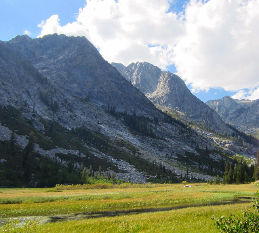
By around 1:00 pm I headed down toward Big Pete Meadow. I passed the famous rock sculpture and later the sign by the Le Conte Ranger Station warning of bears. Some amazing mountain peaks and waterfalls from a hanging valley far far above came into view on the right. The Citadel (11,738 feet) was over 3,000 feet above me and the waterfalls coming down the canyon walls were mesmerizing. I took a few pictures from Grouse Meadows but the sun wasn't cooperating.


Grouse Meadow
The trail from Big Pete Meadow to the Palisade Creek junction was mostly flat and I made good time along Palisade Creek. There were many comfortable camp sites under the forested Deer Meadows area and I passed a few groups already having dinner, but I was hitting my familiar late afternoon stride and I wanted to keep going. . . as usual I was chasing the late afternoon sun. If I was more of a morning person I would have been making an extra five or ten miles a day, but it was time to find a spot to camp. I could see a large waterfall at the end of the canyon and it looked like there might be a plateau at the top.

I raced the sun up the stone switchbacks that lead to the top of the falls. I was bolting up the granite stairs, sometimes bushwhacking through lush ferns that were fed by the many waterfalls and seeps coming down the canyon walls. I figured that at the worst I would just stealth camp anywhere that was reasonably flat, and just as I was loosing hope of finding a descent place to camp. . . I made it to the plateau by the waterfall.

I could hardly believe my luck when I found two small flat spots just big enough for a small tent or bivy right by the top of the waterfall. The view looking back over the canyon was amazing. On either side were huge granite walls rising almost 4,000 feet from the floor of the canyon to Giraud Peak (12,608 ft.) on the right and Mt. Shakespeare (12,174 ft.) on the left. At the opposite end of the canyon were the mountains and peaks of the Black Divide. The Devils Crags, Wheel Mountain (12,774 ft.), Mt. McDuffie (13,282 ft.) and The Citadel (11,739 ft.). I was at the far west end of the canyon and knew I was set for an amazing sunrise.

Camp just below the Golden Staircase. 
Alpenglow.

As I set up my quilt and bivy the sun was making it's way up the canyon walls behind me. I watched the alpenglow too long and ended up making dinner by the waterfall in the dark. Any thought of the 'real world' was long long gone. I was completely taken by the peace of this amazing place. I drifted off to sleep listening to the waterfall and watching the stars come out, framed by the awesome walls of granite on either side.


Camp overlooking Palisade Creek, Deer Meadow and Devils Crags. 

Cooking after sunset.

Click for full size.


Click here for Day Seven


John Muir Trail Thru Hike: Day Five

McClure Meadow to LeConte Canyon: 14.5 miles.


Sept. 16th, 2011.

I woke up refreshed and after grabbing a Pro Bar for breakfast I was back on the trail passing through McClure Meadow and the rest of Evolution Valley. There are some steep switchbacks at the end of the valley that lead up to Evolution Lake and I was out of steam at the top, probably due to my meager breakfast. I took a break at an amazing spot overlooking the tarn just below Evolution Lake and watched deer drinking from the creek in the small valley below.

I met a colorful woman probably in her 70's who was clearly an experienced hiker, but still it seemed strange to see her alone way out in the wilderness. She slowed down enough to say something about having a nice day on 'the bench'. Maybe she was going to Darwin Bench just above us. Anyway, soon an older gentleman passed by and asked about her. He said they were hiking together and that she was definitely a very 'unique' person. These two were just some of the characters I would meet on the trail today.

Colby Meadow looking toward Evolution Basin.

Wow, the first look at Mt. Mendel, Mt. Darwin and Evolution Lake from the JMT. 

The trail along Evolution Lake.

Evolution Lake on the way into Evolution Basin.

As I walked over a small crest Evolution Lake came into view. The contrast between the immense light granite of Mt. Mendel and the deep blue green water of Evolution Lake was amazing. The aqua color of the lake was indescribable. Just as I was walking along the lake a couple of runners passed by with only hydration packs, they seemed completely out of place. It was very strange to see these two cruising along so far out in the wilderness.

Evolution Lake (10,852 ft).
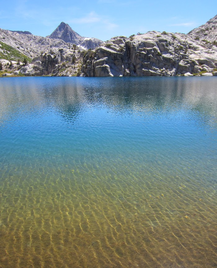
The hike up the Evolution Basin felt like walking on the moon, but with the most crystal clear creeks flowing into amazing lakes and tarns. I was struck by the azure color of Sapphire Lake and then finally Wanda Lake. I have never seen water with such a striking saturated blue color like Wanda Lake. This was becoming the best day on the trail by far.

Crossing Evolution Creek. 

Sapphire Lake (10,966 ft) with Mt. Spencer and the side of Mt. Huxley.

Sapphire Lake

Evolution Basin.
Wanda Lake (11,426 ft).

Wanda Lake and the Goddard Divide. (Click for full size)

Muir Hut at the top of Muir Pass (11,955 ft.)

"The Range of Light"
  
Inside the Muir Hut.

Inside the Muir Hut.

Inside Muir Hut.

Finally at Muir Pass.

Heading south from Muir Pass. Helen Lake on the left. Black Giant (13,330 ft) on the right.

Helen Lake (11,617 ft).
After the final climb to Muir Pass I headed down toward Helen Lake, another crystal clear alpine lake. The lakes on either side of the pass are named after John Muir's daughters. I wished that I could just wander around this area for weeks, but I had to keep moving. On the way down the canyon I passed a large church youth group of 20 or more teens on their way up to the pass. First the bizarre solo woman, the strange ultra marathoners, then the large church group. What would be next?

The water flowing down the sides of the granite canyon walls was beautiful, I could hardly believe this place existed. "I must come back here" I thought to myself almost shouting it out loud, or maybe I did shout it. . . . there didn't seem to be much difference after a week solo in the wilderness.

I was losing light and just kept going as my late afternoon second wind kicked in. I finally found a flat campsite above a small tarn below Black Giant. I set up my bivy and quilt and slept under the stars after eating dinner at sunset.

Video of Evolution Basin and Muir Pass:


Map


Elevation Profile