 |
| Mt. Ansel Adams along the XST - Cross Country Sierra Traverse |
This year the mountain gods provided a tremendous oppor
tunity. . . a three week window during the prime summer season to explore the High Sierra. Through a series of unplanned circumstances my usual one week trip morphed into a three week epic adventure! After pouring over maps and considering many possible routes I finally settled on a cross country traverse of the High Sierra. . . I stitched together portions of the
Sierra High Route,
South Sierra High Route,
Kings Canyon High Basin Route along with some of my favorite cross country alternatives to create a cross country traverse of the High Sierra.
In the end I climbed 25 High Sierra Passes over 257 miles in 22 days. I started preparing for the trip in January and followed
Alan Dixon's training program which included long weekend hikes up to 30 miles per day leading up to the start in July. Some of the climbs and long days were more challenging than I anticipated and the fields of wild flowers at the beginning almost derailed the whole trip. Although I planned on climbing 31 passes over 295 miles I had to skip the sections from the Lyell Fork to Mammoth and Ionian Basin due to allergies. Fortunately I was able to re-energize during a zero day and get back into the wilderness to finish the route.
Many thanks to the endless support from my wife Candy. I missed you!
~ XST 2016 ~
Cross Country Sierra Traverse: 25 Passes over 257 miles.
 |
XST 2016 ~ Cross Country Sierra Traverse
|
Day 1: 6.7 miles
After months of preparation I was feeling excited and anxious to finally get started on the longest solo trek of my life. I tried not to think about the entire trip: 22 days with countless cross country passes, miles of talus fields, endless scree slopes and a few sketchy class III climbs.
Kathleen, a cheerful local shuttle driver, had delivered me from where I left my car at the Lone Pine Campground all the way to the Twin Lakes trailhead near Bridgeport in Northern California. It had been a 3 1/2 hour drive, but now I was on my own all the way back to Mount Whitney. I slowly settled into my usual pace up the first stretch of switchbacks and toward the first cross country route to Horse Creek Pass.
 |
The journey begins: Twin Lakes trailhead in the Hoover Wilderness.
|
The travel logistics of the first day meant that I didn't get started until 3:00 pm, which left just enough time to get over Horse Creek Pass and camp near the top of Spiller Creek Canyon.
Day 2: 10.2 miles
I got an early start but due to a navigation error lost some time getting over Stanton Pass. I was surprised by the somewhat alarming amount exposure during the short section of Class III ledges at the very top of the pass.
The next section of the Sierra High Route travels down into Virginia Canyon and I found myself bushwhacking through dense fields of wildflowers in full bloom. It was beautiful but I would pay the price later due to pollen allergies.
I made camp near Shepherd Lake in preparation for crossing Sky Pilot Col the next morning.
 |
| Camp overlooking Spiller Creek Canyon. |
 |
| Endless fields of wildflowers on the way to Stanton Pass. |
 |
| The view of Virginia Canyon from Stanton Pass |
 |
| Miles of cross country bushwhacking through fields of wildflowers. |
 |
| Camp near Shepherd Lake. Sky Pilot Col (11,650') |
Day 3: 10.4 miles
The approach to Sky Pilot Col felt like an eternity of large talus fields. I discovered a short cut high on the south side of the canyon of talus which lead directly to the final snow field. The steep chute that leads to the top is made up of very loose scree and I had to backtrack once to find the best route. Eventually I made it to the top and enjoyed the relatively easy scree on the other side. The rest of the day was a stroll through beautiful lakes, creeks and waterfalls. The Conness Ridge ascent was steep but only a few hundred feet. From there I stayed too high and ended up having to descend 600' to get back on the right route. I stealth camped near a large flat meadow area just to the south of the Great Sierra Mine.
 |
| The final approach to Sky Pilot Col (11,650') |
 |
| The view from the top, looking back to the north from Sky Pilot Col (11,650') |
 |
| The steep and very loose chute on the north side of Sky Pilot Col (11,650') |
 |
| The view to the south from Sky Pilot Col. |
 |
| Crossing easy granite slabs, looking back toward Sky Pilot Col. |
 |
| The view north from the top of the Conness Ridge. |
 |
| Stealth camp. |
Day 4: 21.7 miles
I realized early on that getting an early start was the key to making the most of each day. I made it over Mineshaft Pass in the early morning and enjoyed a nice easy downhill hike to a real breakfast and resupply at Tuolumne Meadows. It was fun listening to the groups of PCT hikers as we all opened our resupply boxes and re-packed with fresh supplies.
My goal was to make it to the site of the High Sierra Topix annual meetup, but I settled for mid Lewis Creek and found a nice spot away from the mosquitos to have some dinner and relax before going to bed. I slept like a baby after a long strenuous day.
 |
| Remnants of the Old Sierra Mine from Mine Shaft Pass. |
 |
| Old stone house near Mine Shaft Pass. |
 |
| Remnants of mine activity near Mine Shaft Pass. |
 |
| Gaylor Lakes and Peak from Mine Shaft Pass. |
 |
| View to the south from Vogelsang Pass (10,675') |
 |
| Camp along Lewis Creek. |
Day 5: 9.3 miles
By day 5 the fields of wildflowers finally caught up to me and I started to suffer from serious pollen allergies. The intense heat during the day didn't help, it was 98 degrees on the climb out of Lewis Creek! By the time I reached the junction with the Lyell Fork and the turn-off for the High Sierra Topix annual meetup I was spent. I decided to head back to Tuolumne Meadows and catch a ride from one of the HST crew the next day. . . but somehow I figured it would be best to just look for their camp and make the best of it.
After a few hours I discovered the HST camp but there was nobody around. A small note said that everyone had gone to a different spot for dinner so I cleaned up, made dinner and got some much needed rest. Just before sunset everyone arrived and I my morale improved just by being around other people. With my spirits lifted by the kind fellowship of my hiking buddies I started to feel better.
 |
| Mount Ansel Adams. |
 |
| Mountain dudes from HST. |
 |
| Cross country travel along the Lyell Fork. |
Day 6: 21.3 miles
The next morning I hiked a few miles with the HST crew back to the trail junction but decided to head home after continuing to feel worse. I had been taking Dayquil everyday and it just wasn't working. After some somber good-byes I headed back to Tuolumne Meadows. I was disappointed but there was no way I could stay and continue to suffer. . . . still somehow on the hike back I started to feel a little better. I slept at the backpackers camp at Tuolumne Meadows and decided to just see how I felt the next morning.
Day 7: 5.3 miles
I woke up just in time to make the shuttle from Tuolumne Meadows to Mammoth. Somehow the good nights sleep away from the wildflowers had done the trick and I was feeling ready to continue.
Even though I had only been out for a week it already seemed strange seeing the countless tourists struggling under the weight of their oversized backpacks. I smiled from inside the shuttle while watching a guy help his girlfriend lift her gigantic pack onto her back. Ouch!
Once in Mammoth I used their amazing efficient shuttle system to do some errands in town. I am an ultralight backpacker and usually think that I am bringing only the absolute essential gear. . . but once I realized that continuing the journey was realistic, and that I would be carrying 15 days of food, I mailed home everything I could to save weight.
I ended up getting some more salty foods and Hammer Endurolyte supplements to help with the unusually hot conditions and caught the shuttle to Reds Meadow. Once there I went through my two resupply boxes and even left some non-essential food behind to save weight. With 15 days of food and fuel, a liter of water and all of the rest of my gear my pack weighed about 35 lbs. I would suffer later from leaving those few pounds of food behind!
I didn't get back on the trail until 5:00 pm, but there was just enough time to make the few miles over Mammoth Pass and to camp at McCloud Lake.
 |
| Hiking up Mammoth Pass to McCloud Lake. |
 |
| Forest after a fire. |
 |
| Forest rebirth. |
 |
| Full pack with 15 days of food. |
 |
| 15 days of food. |
Day 8: 16.7 miles
It was late July and the bugs were in full force overnight while I camped near McCloud Lake. They weren't mosquitos, but some type of lake fly, and they sounded like rain on the outside of my tent that night! I don't usually bring a tent but I was glad to have one on this trip.
With a full pack and renewed energy I headed up the cross country route to the Mammoth Crest. As I got closer a use trail developed and it became easier to find the 'correct', or at least most used, route to the top. I had been looking forward to this section along the Mammoth Crest and the views did not disappoint. I could see Banner, Ritter, Mammoth Mt., all of the Mammoth Lakes and even some of downtown Mammoth.
I made good time along the crest and before long arrived at beautiful Deer Lakes. The talus approach to Deer Pass was becoming routine and I even made my own route down to the trail along Duck Lake. Once on the JMT I had fun talking to the many other hikers and was entertained by the hoards of people camping right next to Virginia Lake. So much for Leave no Trace.
I left the crowds behind and camped on a granite ridge overlooking Tully Hole.
 |
| Morning on McCloud Lake. |
 |
| Use trail leading to the Mammoth Crest. |
 |
| McCloud Lake from the Mammoth Crest |
 |
| Mammoth Mountain from the Mammoth Crest. |
 |
| View of the Mammoth Lakes from the Mammoth Crest. |
 |
| The Mammoth Crest. |
 |
| Deer Lakes along the Mammoth Crest. |
 |
| The view of Deer Lakes from Deer Pass. |
 |
Making dinner at Purple Lake.
|
 |
| Virginia Lake |
 |
| Virginia Lake. |
 |
| Camping on a ridge above Tully Hole. |
Day 9: 9.9 miles
The climb up to Shout of Relief Pass has some amazing terrain and I had been looking forward to exploring it ever since crossing the Silver Divide on the JMT in 2011. By this time I had fallen into a daily routine of getting an early breakfast of freeze dried granola and coffee and hitting the trail as soon as possible. With some music on my iPod I strolled up the short section of trail and quickly missed my first turn-off. After double checking the map I got re-oriented and made my way up toward the first pass.
The section between Shout of Relief Pass and Bighorn Pass appears easy, but there are two distinct routes. I took the high route (after using the low route in the past) and found some easy ledges that lead directly to Bighorn Pass.
From Bighorn Pass I planned on leaving the usual Sierra High Route and took an alternate route to Grinnell Lakes. After hiking around the lake I found a nice place to camp near the outlet and enjoyed the sunset on Red & White Peak.
 |
| Cross country terrain on the climb to Shout of Relief Pass (11,388') |
 |
| Cotton Lake along the route to Shout of Relief Pass (11,388') |
 |
| The view below Shout of Relief Pass (11,388') |
 |
| The view to the north from Shout of Relief Pass (11,388') |
 |
The view to the south from Shout of Relief Pass (11,440'): Bighorn Pass (11,281')
|
 |
| The view to the south from Shout of Relief Pass (11,440'): Rosy Finch Lake. |
Day 10: 9.6 miles
Hiking along Laurel Creek in the morning was beautiful, and there was a great view of Mt. Gabb in the distance which I would be crossing the following day. Unfortunately most days involved a few thousand feet of elevation loss, only to be followed by a few thousand feet of elevation gain. . . and this day delivered!
I had been through this section of the High Route before and was looking forward to spending the late afternoon exploring Lower Mills Creek Lake. The outlet area of this lake is among my favorite in the Sierra and I spent a few hours taking photos, meditating and swimming. It was an idyllic day in the backcountry.
 |
Recess Peak from Laurel Creek
|
 |
Laurel Creek.
|
 |
| Laurel Creek |
 |
| Laurel Creek |
 |
| Peak 12,200 & Red and White Peak from Laurel Lake. |
 |
| I followed the short section of the Second Recess Trail up toward Mills Creek. |
 |
| The view back towards the Second Recess on the climb to Mills Creek Lake. |
 |
| The outlet of Lower Mills Creek Lake |
 |
| Lower Mills Creek Lake area |
 |
Lower Mills Creek Lake.
|
 |
| Lower Mills Creek Lake. |
 |
Lower Mills Creek Lake.
|
 |
| Sunset on Lower Mills Creek Lake. |
 |
| Panorama of Lower Mills Creek Lake. |
 |
| Camp on Lower Mills Creek Lake. |
Day 11: 11.2 miles
The trip over Gabbot Pass and down to Lake Italy was familiar, as I had done this section before, but I was looking forward to seeing Bear Lakes Basin later in the afternoon. The route finding over Gabbot Pass is straight forward and I made it to the amazing waterfalls and cascades along the outlet of Lake Italy by mid-morning.
Like many of the cross country passes on this trip the headwall of White Bear Pass appeared almost vertical from the distance, but once I got closer a reasonable route became obvious. By approaching the pass straight from the center I found three grassy ledges on the way to the top which made the climb relatively easy.
The lakes and creeks in Bear Lakes Basin were busy with backpackers and I had to pass right by a family camp on the way through the basin. I apologized as I passed by and they all smiled and said it was fine. Everyone that I met out in the backcountry along these cross country routes seemed to be friendly and pleasant.
I camped near Feather Pass, the first pass for the next morning, and had time to do some laundry and clean up before dinner. To save weight I only had one pair of shorts and a t-shirt to hike in, and a set of Montbell wind pants and a Patagonia Houdini windshirt as a back-up for around camp. Since I sent home my down puffy anorak that had a down hood I ended up using my hiking shorts as an extra warm hat on the colder nights.
Eventually I made use of most items for a few different purposes: my poncho was also a pack cover and a ground cloth and bivy bottom. My shorts were also a hat. Extra socks were gloves. Ditty bag became part of my sleep system. My trail runners and tent became a head board when not in use.
 |
| 96 degrees at 10:02 am, at 11,140'. That's hot! |
 |
| Leaving Upper Mills Creek Lake. |
 |
| Cross country route to Gabbot Pass (12,258') |
 |
| North side of Gabbot Pass (12,258') |
 |
| The view to the south from Gabbot Pass (12,258') |
 |
| Sandy beach on Lake Italy. |
 |
| Waterfalls below Lake Italy. |
 |
| Waterfalls and cascades below Lake Italy. |
 |
| Steep headwall on the route to White Bear Pass (11,800') |
 |
View from the top of White Bear Pass (11,800')
|
 |
Top of White Bear Pass (11,800')
|
 |
| Top of White Bear Pass (11,800') |
 |
| Camp in Bear Lakes Basin below Feather Pass (12,320') |
 |
| Camp below Feather Pass (12,320') |
Day 12: 12.3 miles
Today my poncho came in handy during the rain that continued on-and-off throughout the afternoon. I met a couple on the way up Feather Pass, and a father with his two kids at the top. Our little group shared stories and the couple seemed surprised by my trail runners and small backpack. "Are you climbing the High Route in those shoes?" they asked. They were wearing heavy leather boots and big traditional backpacks. HYOH (hike your own hike) I thought, everyone enjoys the backcountry in their own way. From there I strolled down the granite slabs toward La Salle Lake.
By the time I reached Merriam Lake the rain had started so I put on my poncho and headed down into the trees on the descent to French Canyon. The bushwhacking section out of French Canyon and up toward Puppet Lake looked really difficult, and I couldn't see a route that made sense. . . but I just set my compass on a heading a trudged up the forested slope. Surprisingly it only took 20 minutes to get to Elba Lake and from there it was all above treeline and much easier to navigate.
The rain brought some of the wildflowers back to life but the pollen was nothing like the previous weeks. By late afternoon I was feeling a second wind so I climbed Puppet Pass and enjoyed the downhill section through Humphreys Basin. By the time I reached Mesa Lake the aplenglow on Mt. Humphreys was in full effect, a beautiful gift at the end of another day in the High Sierra.
 |
| A couple climbing Feather Pass (12,320') |
 |
| La Salle Lake from Feather Pass (12,320') |
 |
| Meadows below Merriam Lake. |
 |
| Meadows below Merriam Lake. |
 |
| Zpacks Arc Haul during a break in the rain on Elba Lake. |
 |
| Cross country terrain near Puppet Lake. |
 |
| Storm clouds and granite ledges above Elba Lake. |
 |
| Storm clouds clearing from Puppet Pass (12,000') |
 |
| Alpenglow on Mt. Humphreys. |
Day 13: 9.2 miles
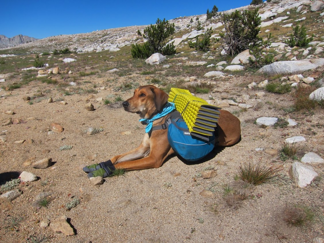
I woke up to crystal clear skies on Mesa Lake and while getting ready a nice couple stopped by to visit. They were asking about my ultralight tent (a Zpacks Hexamid) and we spent the morning talking about gear and the different forums on BPL (backpackinglight.com) and HST (highsierratopix.com). They had a cool backpacking dog who even carried his own gear.
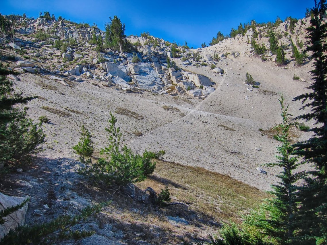
I was looking forward to getting over Snow Tongue Pass and had read a few negative comments in the past about how challenging it can be. To make matters worse I would be climbing it going southbound, which meant I had to climb UP the steep loose scree and talus chute on the north side.
After slowly crossing the tedious talus approach I reached the base of the pass. There appeared to be three possible chutes, and I took the one on the left. It turns out the middle one was probably best, but with only a few tense moments I made it to the top. I wouldn't mind doing it again, but would definitely recommend going northbound next time.
The lakes and streams on the south side were surprisingly pretty and although I hoped to camp at Darwin Bench I ran out of light and camped on the granite ledges overlooking Evolution Meadow.
 |
| Morning on Mesa Lake. |
 |
| Meeting some cool dog-packers! |
 |
Awesome Sierra packer-dog.
|
 |
| Miles of wildflowers in Humphreys Basin. |
 |
| Easy cross country travel in Humphreys Basin. |
 |
Too much talus on the way to Snow Tongue Pass (12,238')
|
 |
| Tedious talus on the way to Snow Tongue Pass (12,238') |
 |
| Looking back toward Humphreys Basin and the Wahoo Lakes from Snow Tongue Pass. |
 |
Steep talus and snow on Snow Tongue Pass.
|
 |
| Very steep route up the north side of Snow Tongue Pass. |
 |
| Yikes! North side of Snow Tongue Pass. |
 |
| Pleasant hiking on the south side of Snow Tongue Pass. |
 |
| Looking back at the easy approach to the south side of Snow Tongue Pass. |
 |
| Camping on a ledge overlooking Evolution Meadow. |
Day 14: 21.4 miles
There is nothing like the feeling of easy cruising on trail after a few days of difficult cross country terrain! After traversing the rest of the ridge toward Darwin Bench I joined the JMT for the rest of the day. It felt like I was strolling up the trail and my pack was finally feeling lighter.
Along the way I met some familiar faces; a couple that I had met two years prior during my
Great Western Divide ~ 2014 trip. They were doing the Sierra High Route with another hiker this year so we shared information about conditions along the route and eventually headed our separate ways.
I had been through Evolution Basin just a month earlier on a training hike and it was interesting to see how different it was without snow! With a clear trail and acclimated legs I kicked up some trail dust and finally made camp past Grouse Meadow.
 |
| Evolution Lake |
 |
Evolution Lake.
|
 |
| Evolution Lake. |
 |
| The John Muir Trail in Evolution Basin. |
 |
| The JMT in Evolution Basin. |
 |
| Mt. Darwin from the outlet of Sapphire Lake. |
 |
| Muir Hut @ Muir Pass (11,955') |
 |
The JMT in Evolution Basin.
|
 |
| View of Wanda Lake from Muir Pass (11,955') |
 |
| Descending to Helen Lake from Muir Pass on the JMT. |
 |
| Beautiful crystal clear water in Helen Lake. |
 |
| I can't get enough of Helen Lake. |
 |
| Panorama of Helen Lake. |
 |
| Beautiful tarn on the JMT. |
 |
| Familiar Faces on the JMT. |
 |
| Last light near Grouse Meadow. |
Day 15: 8.3 miles
After hiking and climbing hard for two weeks, and living on a very limited backpacking diet, I started to feel the effects of long term calorie deficiency. I noticed a need to take longer breaks and an overall lack of energy at times. . . but I still made it up Cataract Creek to Amphitheater Lake before sunset!
The route from Palisades Creek to the beginning of Cataract Creek was difficult to find, but once I got out of the thick shrubs and up to the first waterfall things got easier. I noticed many more cairns than usual, and they all very clearly lead the way up the creek. There were only single rock cairns (instead of the usual pile of three) but they were consistent and relatively easy to follow.
It turns out the reason for the well marked route was that the NPS had recently setup a camp in Amphitheater Lakes Basin while putting gill nets in some of the lakes. Their camp was vacant but it was a little strange to find such a large established camp in a remote basin.
 |
| Cross country terrain up Cataract Creek. |
 |
| Cross country terrain up Cataract Creek. |
 |
Looking back down Cataract Creek.
|
 |
| NPS camp at Amphitheater Lake basin |
 |
| NPS camp at Amphitheater Lake. |
 |
| Gill nets at Amphitheater Lake. |
 |
| Sunset view of the Palisades and beyond from Amphitheater Lake. |
 |
| Alpenglow on Amphitheater Lake. |
Day 16: 9 miles
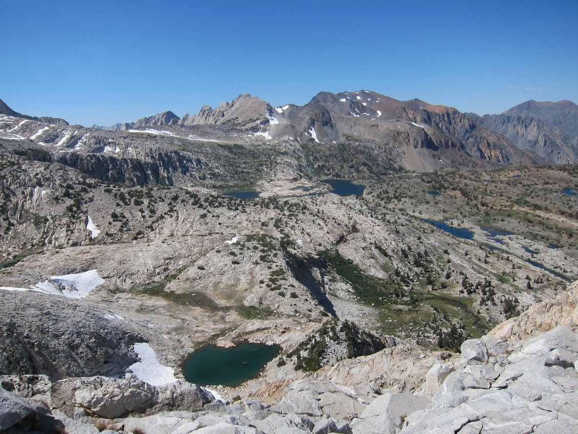
Today I would cross two cross country passes and visit three remote basins. I started with Cataract Creek Pass which still had a small snowfield at the top. There is a long-ish approach with some talus along the lake on the north side but the south side is a pleasant stroll down into Dumbbell Lakes Basin.
I was looking to seeing a specific lake in Dumbbell Lakes Basin that is special (to me at least). It sits in the upper section of the basin with a pronounced un-named peak right at the shoreline (Peak 12,882'). A picture of this lake and peak was featured in a trip report by the late Larry Conn called
Taboose and the Lake Basins on High Sierra Topix and ever since reading his report I have wanted to sit on the shore of this lake. I felt fortunate to have the opportunity to see this lake in person and I took a moment to remember the huge contribution Larry Conn made to the community at High Sierra Topix. His many trip reports provided years of inspiration for me.
While in Dumbbell Lakes Basin I met another member of High Sierra Topix named Asolthane who was spending the day fishing the lakes in the area. He mentioned that Maverick, one of the moderators at High Sierra Topix, had given him a few detailed route suggestions in the area. I have also had the opportunity to follow route suggestions from Maverick at HST. It felt good to find another one of our crew out in this remote basin.
After climbing Dumbbell Pass the route into Lakes Basin felt like a vacation! Dumbbell Pass is not difficult, but it has a section with some tedious talus that really slows things down.
The view into Lakes Basin from the pass was fantastic and I had been waiting to exploring this basin more after passing through it quickly while doing the
Sierra High Route in 2012. Lakes Basin has an almost perfect combination of lakes, creeks, waterfalls and big mountain scenery. After dinner by one of the lakes I setup a cowboy camp with close up views of the sunset light show on the surrounding peaks.
 |
| Morning from Amphitheater Lake. |
 |
| Amphitheater Lake. |
 |
| Panorama of Amphitheater Lake on the way to Cataract Creek Pass (11,520') |
 |
| Snowfield visible in the V shaped notch in the middle of the ridge. |
 |
| Snowfield at the top of Cataract Creek Pass (11,520') |
 |
| Snowfield at the top of Cataract Creek Pass (11,520') |
 |
| Panorama to the north from Cataract Creek Pass (11,520') |
 |
| The view to the north from the top of Cataract Creek Pass (11,520') |
 |
| The view to the north from the snowfield at Cataract Creek Pass (11,520') |
 |
| Dumbbell Lakes Basin. |
 |
| A memorable lake in Dumbbell Lakes Basin (aka Larry Conn Lake). |
 |
| Dumbbell Lakes Basin. |
 |
| Dumbbell Lakes on the climb up Dumbbell Pass (11,723') |
 |
| Merriam Lake to the south from Dumbbell Pass (11,723') |
 |
| Panorama of Lakes Basin from Dumbbell Pass (11,723') |
 |
| Alpenglow in Lakes Basin. |
 |
| Cowboy camp in Lakes Basin. |
Day 17: 11.5 miles
The next day I followed the faint remnants of the original John Muir Trail through Lakes Basin toward Cartridge Pass. Although the trail has not been maintained for decades there was a use trail to the top that was easy to follow. The views back into Lake Basin were spectacular, but I was surprised by the views to the south on the other side. . . because from there I could see the next pass that I hoped to cross later that same day. It looked like it was impossibly far away, and there was a huge canyon (the Muro Blanco) that I would need to descend, then climb out of to get there!
As usual I just took it one step at a time and by lunch I was 2,400 feet below in the bottom of the Muro Blanco. Unfortunately I would need to climb back up 2,400 feet through some complex cross country terrain to get over Arrow Pass. Somehow I just kept going and made it up the south wall of the Muro Blanco and up to the serene creeks and waterfalls in the basin to the north of Arrow Peak.
It was in this basin that I came across some white-washed waterfalls. The water was especially clear and the rocks in the creekbed and in the waterfalls were all white. After a while I came across some beautiful emerald pools. . . but they were an emerald color I had only seen in the hot sulfur pools in Yellowstone. As I continued through the basin I found more of these amazing emerald pools. I could hardly believe my eyes. How could I have never heard of these emerald pools?
Eventually I found the source of the pools at the headwaters of the creek and lakes. A large rust colored area was visible along the steep ridge at the top of the basin, and there was a lake with the same emerald colors at the base of the ridge.
The shadows were getting long when I finally made it over Arrow Pass, but there was still time to make camp near one of the lakes in Arrow Basin. My late afternoon second wind kicked in and I hiked until 8:30 pm.
 |
| A hint of the 'Old JMT' still visible in Lakes Basin. |
 |
| Cartridge Pass (12,162') from Lakes Basin. |
 |
| Lake Basin from Cartridge Pass (12,162') |
 |
| Ice field on top of Cartridge Pass (12,162') |
 |
| The view to the south from Cartridge Pass (12,162'). I would climb over the distant ridge later that day. |
 |
| Strange white-washed creek. |
 |
| Mysterious Emerald Pools. |
 |
| Amazing Emerald Pools. |
 |
| The source of the Emerald Pools. |
 |
| The view on the climb to Arrow Pass (11,685') |
 |
| Talus field on the way to Arrow Pass (11,685') |
 |
| The view to the south into Arrow Basin from Arrow Pass (11,685') |
Day 18: 9.6 miles
My limited diet or the effects of drinking the sulfur water the day before really started to take a toll on my energy on day 18. . . but it's hard to feel bad when surrounded by unlimited beauty. The route was downhill for most of the morning and I easily contoured down through Arrow Basin and to the top of Window Creek. From here there it was an 1,800 foot drop to Woods Creek below that was steep and challenging at times.
After dinner at Castle Domes Meadow I followed a pleasant trailed section to the Woods Creek suspension bridge and setup camp at an established site along with the crowds at this popular intersection. It actually felt good to be surrounded by other people for a change.
 |
| Castle Domes Meadow. |
 |
| Woods Creek suspension bridge. |
 |
| Camping near the Woods Creek suspension bridge. |
Day 19: 15.8 miles
By day 19 each morning was beginning to become a struggle. My stomach felt like it was eating itself from the inside and I needed to rest more than usual throughout the morning. . . but after a few snacks I was usually back to feeling strong in the afternoon. I am definitely bringing more food on my next long trek!
I followed the JMT up to Arrow Lake then left the trail and set off toward Basin Notch, a cross country short-cut, into 60 Lakes Basin. Soon I reached the south end of 60 Lakes Basin and from there I climbed Rae Col and on to Glen Pass.
After an unbelievably good dinner (even freeze-dried beef stew tasted like gourmet food by then) at the top of Glen Pass I headed downhill for an easy few miles to Vidette Meadow. By 8:00 pm I discovered the last available established camp at Vidette Meadow so I camped with some friendly JMT thru-hikers.
 |
| The view from the top of Basin Notch, the cross country shortcut into 60 Lakes Basin. |
 |
| 60 Lakes Basin from Rae Col (11,711') |
 |
| Rae Col visible at the top of the ridge in 60 Lakes Basin. |
 |
| 60 Lakes Basin. |
 |
| View from Glen Pass. |
 |
| The route on the south side of Rae Col. |
 |
| Long shadows during the late descent to Vidette Meadow. |
Day 20: 13.5 miles
After an early morning stroll up a beautiful section of the JMT I found the subtle cairns leading the way to Center Basin. This was the toughest day for me as I was struggling most of the time to make the climb to Junction Pass. Once at the top the spectacular views seemed to make it all worth it. It felt like I was looking back over most of the Sierra that I had traversed over the past three weeks. I had fun scree skiing down the slope on the south side, but was met with a long talus field on the way to camp at "The Pothole".
 |
| Center Basin. |
 |
| Panorama from Junction Pass (13,200') |
 |
| Panorama from Junction Pass (13,200') |
 |
| Looking back into Center Basin from Junction Pass (13,200'). |
 |
| Finally at the top of Junction Pass (13,200') |
 |
| Scree slope on the south side of Junction Pass. |
 |
| Endless talus field on the south side of Junction Pass. |
 |
Camp in "The Pothole" below Shepherd Pass (12,000')
|
Day 21: 16.9 miles
I cross Shepherd Pass in the morning on the way to Rockwell Pass and on to two remote basins: Wright Lakes Basin and Wallace Lakes Basin. Once over Rockwell Pass the cross country terrain was mostly easy walking through pleasant meadows and granite ledges.
 |
| Shepherd Pass (12,000') |
 |
| The Great Western Divide from Shepherd Pass (12,000'). |
 |
| Wright Lakes Basin. |
 |
| Easy cross country terrain in Wright Lakes Basin. |
 |
| Wright Lakes Basin. |
 |
| Cross country terrain in Wallace Lake Basin. |
 |
| Meadows in Wallace Lake Basin. |
 |
| Meadows in Wallace Lake Basin. |
 |
| Cross country terrain in Wallace Lake Basin. |
 |
| Wales Lake. |
 |
| Camping below Mt. Russell. |
 |
| Sunset from above Wales Lake. |
Day 22: 12.6 miles
This would be my final day of the traverse, and I still had a last cross country pass to climb and an 8,000 foot descent to Lone Pine Campground.
From Tulainyo Lake I could see the headwall of Russell-Carillon Col, and as usual it looked steep. Eventually the talus approach became steeper and after climbing the final Class III ledges I made it to the top. There were great views of the east face of Mt. Whitney and the entire region on the way down to the Mountaineers Route. Once I made it to Lone Pine Creek the Mountaineers Route was easy to follow and in some places the use trail looked almost like a maintained route.
I knew Whitney Portal was near when I could smell the cheese burgers. . . but I still had a few miles to hike down to my car!
 |
| Morning from above Wales Lake. |
 |
| Wallace Lake Basin (Wales Lake on the left, Wallace Lake on the right). |
 |
The highest lake in North America: Tulainyo Lake (12,825').
|
 |
| Russell-Carillon Col (13,280') from Tulainyo Lake. |
 |
| The final climb to Russell-Carillon Col (13,280') |
 |
| One happy hiker. . . after climbing Russell-Carillon Col (13,280'), the final pass of the XST! |
 |
| Mt. Whitney & Mt. Russell. |
 |
| My car is parked way down in that valley! |
 |
| The view back up towards the x/c route to Russell-Carillon Col. |
 |
| The x/c route down from Russell-Carillon Col to the Mt. Whitney Mountaineers Route. |
 |
| Lone Pine Creek along the Mt. Whitney Mountaineers Route |
 |
| The Ebersbacher Ledges on the Whitney Mountaineers Route. |
 |
| The Ebersbacher Ledges on the Whitney Mountaineers Route. |
Finally at Whitney Portal!
 |
| Whitney Portal. |
 |
| One dirty hiker after 22 days in the backcountry. |
 |
| Pack weigh-in at Whitney Portal. |
 |
| 10 lb base weight including 15 days of trash at Whitney Portal. |
 |
| Exploded pack view, just the essentials. |
Thanks for reading.
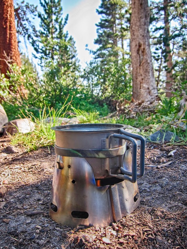
XST 2016 ~ Gear List
With all of my gear plus 15 days of food and fuel and 1 liter of water my heaviest pack weight was just under 35 lbs.
 |
| XST 2016 ~ Gear List (with 15 days of food) |


There must be a God!! Awesome photos!!! Thanks for sharing Andy :-)
ReplyDeleteRight on! Thanks👍
DeleteHoly Cow! What a trip.
ReplyDeleteThanks Sekihiker!
Delete