 |
| Snow dudes. |
This spring my hiking compadre Karl extended an invitation to join him on his annual early season hike on the PCT. I am used to snow in the High Sierra, and I usually bring snowshoes and serious winter gear. . . but Karl assured me that in the early spring we could go without the usual winter setup and hike on the snow with trail runners. I watched the forecast and snow level indicators online, and it looked like we lucked out and would be enjoying a rare week-long window of sunny skies and plenty of hard packed snow!
Day 1 - 5/31/2106
N Lake TH - upper Lamarck plateau
3.1 miles
 |
| Our route on the PCT in June. |
After leaving our cars at the Onion Valley trailhead we took a shuttle ride from a friendly local to our starting point, the North Lake trailhead. Since most of the day was already taken up by logistics we only had time to make a few miles to the plateau above Upper Lamarck Lake. Once we were dropped off at the North Lake trailhead there was no turning back. The only way back was through snow spring conditions all the way back to our cars at the Onion Valley trailhead. . . about 72 miles away.
 |
| North Lake trailhead. |
 |
| Spring conditions with just a little snow at lower elevations. |
 |
| Steep cross country climb above Upper Lamarck Lake. |
 |
| The usual route was covered with snow. |
 |
| Cross country alternative above Upper Lamarck Lake. |
 |
| We made it! The view from the ridge above Upper Lamarck Lake. |
 |
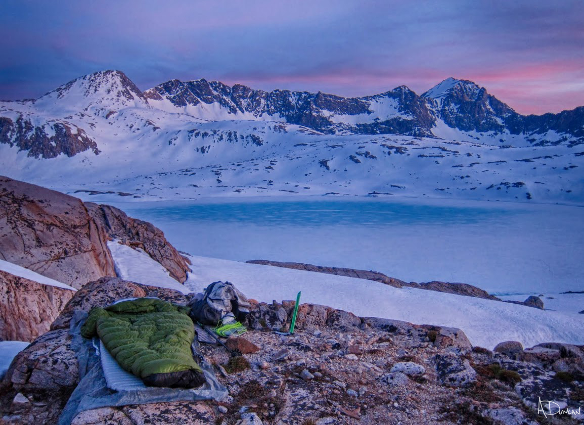
| Camp on the Lamarck plateau. |
 |
| Camp on the Lamarck plateau. |
Day 2 - 6/1/2106
upper Lamarck plateau - Lamarck col - Darwin canyon - JMT - Wanda lake
10.4 miles
With an early start we hiked through solid snow toward Lamarck Col. I had been over this pass just a month before, and several times in the snow, and it was much easier in the solid spring snow.
Once over the Sierra Crest things got much easier. The climb down from Lamarck Col is an easy stroll downhill with some mixed terrain around the lakes. After a break at the JMT junction we continued on through beautiful Evolution Basin and made camp above the shore of Wanda Lake.
 |
| Approaching Lamarck Col. |
 |
| Almost there, climbing Lamarck Col in the snow. |
 |
| The top of Lamarck Col. |
 |
| Panorama looking into Darwin Canyon from Lamarck Col. |
 |
| Darwin Canyon. |
 |
| Cross country travel through Darwin Canyon. |
 |
| Frozen Darwin Bench. |
 |
| Outlet of Darwin Bench. |
 |
| Entering Evolution Basin. |
 |
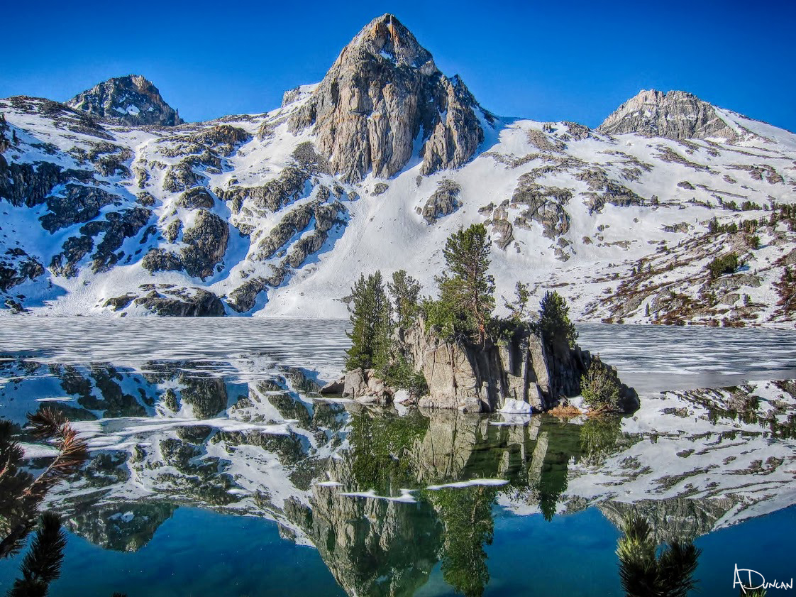
| Panorama of Mt. Darwin, Mt. Mendel and Evolution Lake. |
 |
| Evolution Lake. |
 |
| Evolution Creek crossing. |
 |
| Frozen Evolution Basin. |
 |
| View of Darwin & Mendel from Evolution Basin. |
 |
| Mt. Huxley from Sapphire Lake. |
 |
| Outlet of Wanda Lake. |
 |
| The view from our camp above Wanda Lake. |
 |
| Sunset on the Goddard Divide. |
 |
| Karl making dinner above Wanda Lake. |
 |
| Camp above Wanda Lake. |
 |
| Sunset above Wanda Lake. |
Day 3 - 6/2/2106
Wanda lake - Muir Pass - Palisades waterfall
17.6 miles
Karl is a morning person and he hit the trail (or snow) hard right from the start. I am a night person and I struggled just to warm up while watching my hiking companion speed up to Muir Pass first thing in the morning. With no Starbucks in the backcountry I slowly made my way to the pass.
We met many PCT hikers along the way and that morning Muir Hut was full of PCT'ers having breakfast. Everyone was friendly and we had a good time chatting and sharing stories.
The rest of the morning was a downill stroll through some amazing terrain, made all the more beautiful by the snow cover. By afternoon some of the snow was getting soft and difficult to navigate and were glad to arrive at solid ground during the second half of the day. Hiking on a 'real trail' with no snow was a breeze compared to the post-holing in the snow we had experienced on some of the snow.
Along the way we met Dave, the first JMT hiker of the season from the Czech Republic. We gave Dave the trail name 'Tenacious D' because he had trudged through miles of snow all the way from the beginning of the JMT in Yosemite Valley with heavy gear, but was still smiling. Dave's tenaciousness took on legendary status as this trip progressed! He was a welcome addition to our small group and we all camped at the waterfall just below the Golden Staircase.
 |
| Early morning start up to Muir Pass. |
 |
| Muir Hut. |
 |
| Karl at Muir Hut. |
 |
| Shorts in the snow at Muir Hut. |
 |
| The view of frozen Wanda Lake from Muir Pass. |
 |
| The easy downhill hike from Muir Pass. |
 |
| Frozen Helen Lake. |
 |
| Frozen Helen Lake. |
 |
| Looking back towards Muir Pass from frozen Helen Lake. |
 |
| Outlet of Helen Lake. |
 |
| Meadows melting below treeline. |
 |
| A welcome bath along the way. |
 |
| Camp above Deer Canyon. |
 |
| Homemade sleeping bag and backpack. |
 |
| Dinner companion. |
Day 4 - 6/3/2106
Golden Staircase - Mather Pass - S fork Kings - Lake Marjorie
12.6 miles
The next morning our group of three was up early and ready to hit Mather Pass before the snow got soft.
We headed up the Golden Staircase and made good time through the outlet area below Palisade Lake (one of my favorite areas along the trail). . . It was in this area that the footsteps from the dog in the group ahead of us became more pronounced. They must have hiked well into the late afternoon because the little dog prints were deep, he must have suffered through miles of doggy post holing.
We eventually caught up to the group with the dog. We expected to see a young strong dog, but the poor old dog was limping and had a gray beard.
The middle section of Upper Basin was flooded in some areas and the creek crossing were deep. Tenacious D made the crossing barefoot.
Unfortunately he post holed barefoot in deep snow just after crossing the river and got a deep cut on his ankle. He seemed unaffected by the injury while we helped search for supplies in his first aid kit, but he was out of all disinfectants. He pushed the cut closed while I helped him wrap a bandage around his ankle. He refused any more help and just put his pants and boots back on. After helping to get him stabilized we let him know where we planned to camp that night and parted ways, not really expecting to see him again.
The hike up to Lake Marjorie was a challenging way to end the day. Short sections of trail were constantly interrupted by large piles of snow, creating a roller coaster effect while also climbing 1,000' to the lake. But once we passed treeline things got easier and we made it to a familiar camp spot just below Lake Marjorie. This would be the third time I have camped in this same spot.
Then just as we were ready to call it a day and climb into our sleeping bags. . . Tenacious D shows up! We couldn't believe he made it!!
I forgot to mention the river crossing earlier that day at the South Fork Kings River was dangerously high and it appeared to be at full spring melt levels. Hobbes found a spot downstream from the trail crossing where the river split into three "smaller" rivers and after we watched a small group of PCT'ers cross we carefully made the crossing. It was the strongest river crossing I've ever made. After making the crossing I just figured Tenacious D would turn back and hike out via the Taboose trail. But he was standing in front of us smiling.
He told us the story of how he found a log crossing about 1/4 mile upstream and how he was able to make the crossing without taking off his boots, pants etc.
Hobbes gave him some fuel (he was out) to make dinner. . . then he unpacked a CAN of tomato sauce for his spaghetti. Old school.
 |
| Early morning hike up the Golden Staircase. |
 |
| Palisades Lake looking toward Mather Pass. We would climb up and over this pass later that morning. |
 |
| Hikers and their old snow dog. |
 |
| The final climb up to Mather Pass. |
 |
| Almost to Mather Pass. |
 |
| The view from the top of Mather Pass, looking back toward Palisades Basin. |
 |
| Taking a welcome break at the top with Tenacious D. |
 |
| Tenacious D and Karl hiking down the south side of Mather Pass. |
 |
| Upper Basin on the way to Lake Marjorie. |
 |
| Tenacious D crossing the creek. |
 |
| Camp with a view of Upper Basin and Mather Pass in the distance. |
 |
| Tenacious D arriving at sunset. |
Day 5 - 6/4/2106
Marjorie tarns - Pinchot pass - Rae lakes
16.8 miles
The next day we got an early start over Pinchot Pass, cruised down to the Woods Creek bridge and camped on a plateau overlooking the last Rae Lake. This was a beautiful section and the photos are worth more than anything I can try to describe in words!
 |
| The view of Upper Basin and the Palisades on the climb to Pinchot Pass. |
 |
| The view to the north from Pinchot Pass. |
 |
| The view to the south from Pinchot Pass. |
 |
| Tenacious D and Karl slowly finding the way down Pinchot Pass. |
 |
| Panorama looking back toward Pinchot Pass. |
 |
| Andy wearing shorts in the snow?! |
 |
| Karl on Woods Creek suspension bridge. |
 |
| Sunset on the Painted Lady from camp above Rae Lakes. |
Day 6 - 6/5/2106
Rae Lakes - Glen Pass - Kearsarge Pass - Onion Valley
11.5 miles
Before making camp the night before Karl left a note on the trail for Tenacious D showing where we had stopped for the night, but Tenacious D never showed up and again we assumed he had hiked out.
But early the next morning we ran into a PCT'er who told us Tenacious D was actually camped in the rocks and snow at the base of Glen Pass. He had missed the note on the trail and figured that we wouldn't miss him if he camped right along the route to the pass. . . he had hiked until 11:00 pm and camped in the snow!
The new ice axe that Hobbes had highly recommended I get before the trip came in handy on the very steep snow climb on the north side of Glen Pass. The tracks from the early PCT'ers ignored the switchbacks and went straight up in some sections and although there were steps kicked into the snow, it was steep and a little treacherous in one area.
While resting on the pass Tenacious D showed us the painful cuts, deep scrapes and abrasions on his ankles that had been slowing him down that morning. We immediately "offered" (demanded) to help him get medical attention and hike out with us via Kearsarge Pass. Since all of his food required a fire or stove to cook he hadn't eaten since the night before at the Woods Creek bridge and in his weak state he finally agreed to follow us out and get some help in town.
We were greeted by a mixed group of day hikers and PCT hikers at the top of Kearsarge Pass. Karl and Tenacious D arrived first and must have shared some of the recent events because when I arrived people were tossing food to me!
 |
| Frost after a cold night. |
 |
| Sunrise reflection on Rae Lakes. |
 |
| Sunrise on Rae Lakes. |
 |
| We would climb through the snow to reach Glen Pass (center/top of the photo). |
 |
| Tenacious D from his camp in the snow. |
 |
| Tenacious D on the snow climb to Glen Pass. |
 |
| The view to the north from Glen Pass. |
 |
| Karl and Tenacious D on Glen Pass. |
 |
| Tenacious D showing us his injured ankle. |
 |
| Snow covered switchbacks on the south side of Glen Pass. |
 |
| Panorama of Bullfrog Lake and beyond. |
Many thanks to Karl for the invitation to join his annual spring Sierra trip this year. He was spot on regarding the snow conditions and the fun of meeting the early season PCT'ers each day. Karl gave generously of his time and took Tenacious D to town to make sure that he got the medical attention he needed and lodging for the night. A few weeks later we all met for dinner and I had the opportunity to meet some of the family, catch up with Tenacious D and drop him off at LAX. This was a fun adventure and I look forward to doing it again next year!


No comments:
Post a Comment